You are here: Home > Network List > IC - New China Digital Seismograph Network Stations List
> Station HIA Hailar, Neimenggu Autonomous Region, China > Earthquake Result Viewer
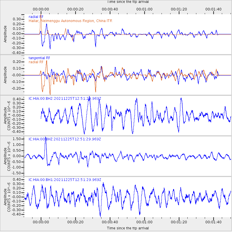
HIA Hailar, Neimenggu Autonomous Region, China - Earthquake Result Viewer
*The percent match for this event was below the threshold and hence no stack was calculated.
| Earthquake location: |
Tonga Islands |
| Earthquake latitude/longitude: |
-17.0/-173.5 |
| Earthquake time(UTC): |
2021/12/25 (359) 12:39:09 GMT |
| Earthquake Depth: |
8.6 km |
| Earthquake Magnitude: |
5.9 mb |
| Earthquake Catalog/Contributor: |
NEIC PDE/us |
|
| Network: |
IC New China Digital Seismograph Network |
| Station: |
HIA Hailar, Neimenggu Autonomous Region, China |
| Lat/Lon: |
49.27 N/119.74 E |
| Elevation: |
620 m |
|
| Distance: |
88.4 deg |
| Az: |
322.985 deg |
| Baz: |
118.434 deg |
| Ray Param: |
$rayparam |
*The percent match for this event was below the threshold and hence was not used in the summary stack. |
|
| Radial Match: |
60.564445 % |
| Radial Bump: |
389 |
| Transverse Match: |
71.35085 % |
| Transverse Bump: |
400 |
| SOD ConfigId: |
26694651 |
| Insert Time: |
2022-01-08 13:11:27.384 +0000 |
| GWidth: |
2.5 |
| Max Bumps: |
400 |
| Tol: |
0.001 |
|
Signal To Noise
| Channel | StoN | STA | LTA |
| IC:HIA:00:BHZ:20211225T12:51:29.969Z | 4.387248 | 6.6916124E-7 | 1.5252414E-7 |
| IC:HIA:00:BH1:20211225T12:51:29.969Z | 1.6200516 | 1.5795554E-7 | 9.750032E-8 |
| IC:HIA:00:BH2:20211225T12:51:29.969Z | 1.7423306 | 2.3437995E-7 | 1.3452095E-7 |
| Arrivals |
| Ps | |
| PpPs | |
| PsPs/PpSs | |


