You are here: Home > Network List > IC - New China Digital Seismograph Network Stations List
> Station HIA Hailar, Neimenggu Autonomous Region, China > Earthquake Result Viewer
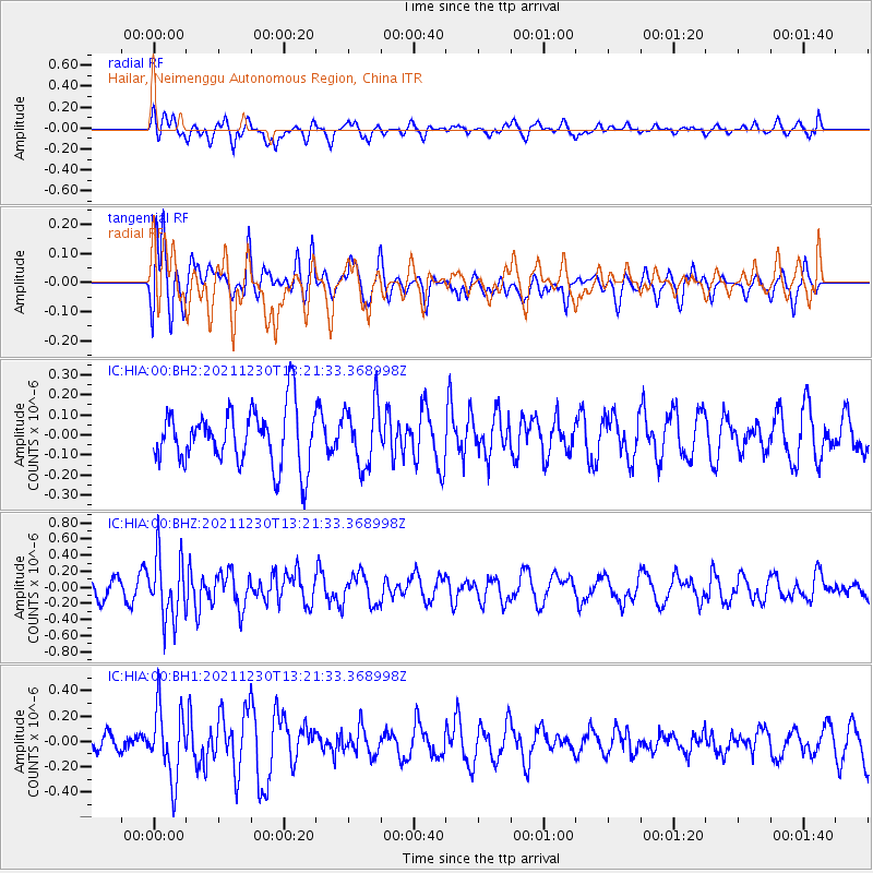
HIA Hailar, Neimenggu Autonomous Region, China - Earthquake Result Viewer
*The percent match for this event was below the threshold and hence no stack was calculated.
| Earthquake location: |
Southern Molucca Sea |
| Earthquake latitude/longitude: |
-0.2/125.2 |
| Earthquake time(UTC): |
2021/12/30 (364) 13:13:19 GMT |
| Earthquake Depth: |
60 km |
| Earthquake Magnitude: |
5.4 Mww |
| Earthquake Catalog/Contributor: |
NEIC PDE/us |
|
| Network: |
IC New China Digital Seismograph Network |
| Station: |
HIA Hailar, Neimenggu Autonomous Region, China |
| Lat/Lon: |
49.27 N/119.74 E |
| Elevation: |
620 m |
|
| Distance: |
49.5 deg |
| Az: |
355.259 deg |
| Baz: |
172.751 deg |
| Ray Param: |
$rayparam |
*The percent match for this event was below the threshold and hence was not used in the summary stack. |
|
| Radial Match: |
42.716537 % |
| Radial Bump: |
366 |
| Transverse Match: |
44.02338 % |
| Transverse Bump: |
400 |
| SOD ConfigId: |
26694651 |
| Insert Time: |
2022-01-13 13:20:27.139 +0000 |
| GWidth: |
2.5 |
| Max Bumps: |
400 |
| Tol: |
0.001 |
|
Signal To Noise
| Channel | StoN | STA | LTA |
| IC:HIA:00:BHZ:20211230T13:21:33.368998Z | 3.3114514 | 3.9519261E-7 | 1.1934121E-7 |
| IC:HIA:00:BH1:20211230T13:21:33.368998Z | 3.0845077 | 2.767023E-7 | 8.970712E-8 |
| IC:HIA:00:BH2:20211230T13:21:33.368998Z | 1.0932269 | 1.538033E-7 | 1.4068745E-7 |
| Arrivals |
| Ps | |
| PpPs | |
| PsPs/PpSs | |


