You are here: Home > Network List > IC - New China Digital Seismograph Network Stations List
> Station HIA Hailar, Neimenggu Autonomous Region, China > Earthquake Result Viewer
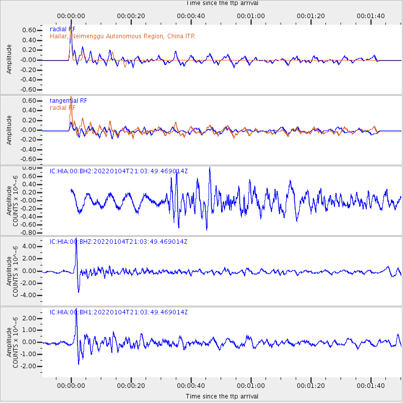
HIA Hailar, Neimenggu Autonomous Region, China - Earthquake Result Viewer
*The percent match for this event was below the threshold and hence no stack was calculated.
| Earthquake location: |
Banda Sea |
| Earthquake latitude/longitude: |
-4.8/125.1 |
| Earthquake time(UTC): |
2022/01/04 (004) 20:55:47 GMT |
| Earthquake Depth: |
556 km |
| Earthquake Magnitude: |
6.0 mww |
| Earthquake Catalog/Contributor: |
NEIC PDE/us |
|
| Network: |
IC New China Digital Seismograph Network |
| Station: |
HIA Hailar, Neimenggu Autonomous Region, China |
| Lat/Lon: |
49.27 N/119.74 E |
| Elevation: |
620 m |
|
| Distance: |
54.0 deg |
| Az: |
355.705 deg |
| Baz: |
173.458 deg |
| Ray Param: |
$rayparam |
*The percent match for this event was below the threshold and hence was not used in the summary stack. |
|
| Radial Match: |
78.22365 % |
| Radial Bump: |
330 |
| Transverse Match: |
65.34709 % |
| Transverse Bump: |
400 |
| SOD ConfigId: |
26694651 |
| Insert Time: |
2022-01-18 21:01:21.192 +0000 |
| GWidth: |
2.5 |
| Max Bumps: |
400 |
| Tol: |
0.001 |
|
Signal To Noise
| Channel | StoN | STA | LTA |
| IC:HIA:00:BHZ:20220104T21:03:49.469014Z | 19.27665 | 1.6862483E-6 | 8.747622E-8 |
| IC:HIA:00:BH1:20220104T21:03:49.469014Z | 12.586885 | 9.588301E-7 | 7.617692E-8 |
| IC:HIA:00:BH2:20220104T21:03:49.469014Z | 1.3794552 | 1.9804749E-7 | 1.4356935E-7 |
| Arrivals |
| Ps | |
| PpPs | |
| PsPs/PpSs | |


