
XIXI YL.XIXI - Earthquake Result Viewer
| ||||||||||||||||||
| ||||||||||||||||||
| ||||||||||||||||||
|
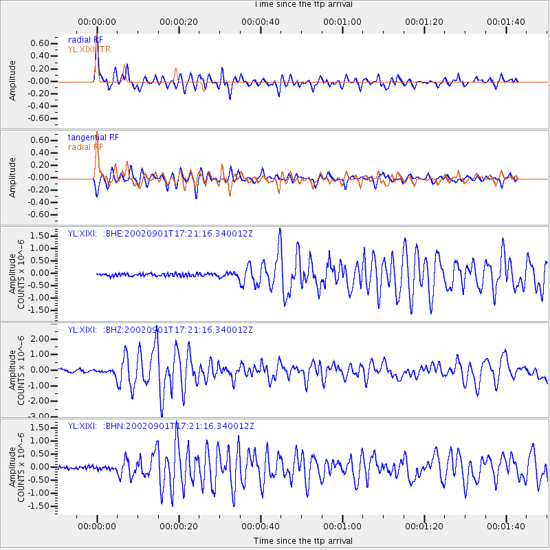
Signal To Noise
| Channel | StoN | STA | LTA |
| YL:XIXI: :BHZ:20020901T17:21:16.340012Z | 1.9302758 | 1.4728893E-7 | 7.63046E-8 |
| YL:XIXI: :BHN:20020901T17:21:16.340012Z | 0.7828346 | 4.4794334E-8 | 5.722069E-8 |
| YL:XIXI: :BHE:20020901T17:21:16.340012Z | 1.851827 | 8.7548E-8 | 4.7276554E-8 |
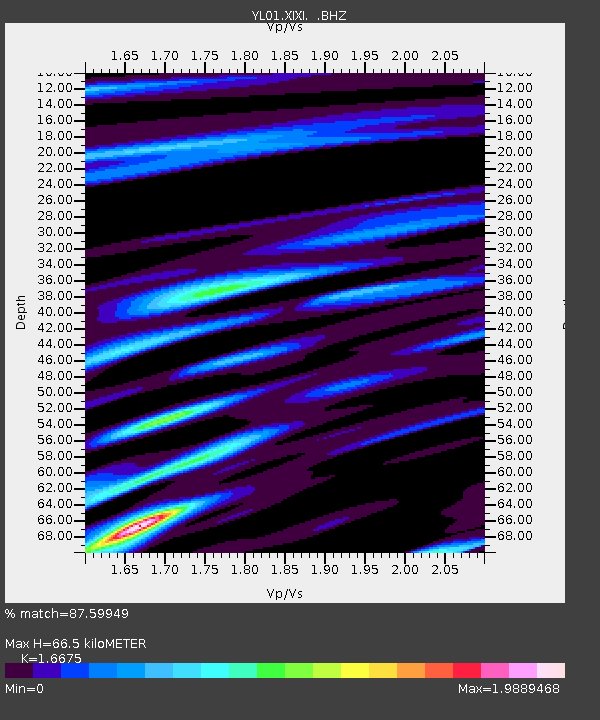
| Arrivals | |
| Ps | 7.4 SECOND |
| PpPs | 25 SECOND |
| PsPs/PpSs | 33 SECOND |

