XIXI YL.XIXI - Earthquake Result Viewer
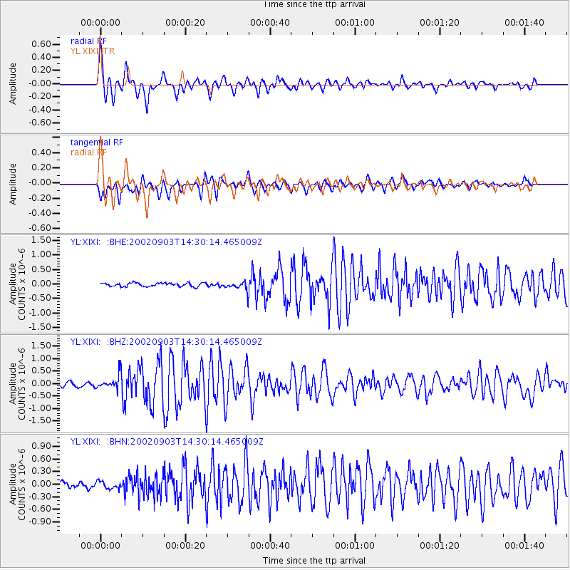
Earthquake location: Mindoro, Philippines
Earthquake latitude/longitude: 13.5/120.8
Earthquake time(UTC): 2002/09/03 (246) 14:23:45 GMT
Earthquake Depth: 10 km
Earthquake Magnitude: 5.5 MB, 5.4 MS, 5.9 MW, 5.8 MW
Earthquake Catalog/Contributor: WHDF/NEIC
Network: YL Himalayan Nepal Tibet Experiment
Station: XIXI YL.XIXI
Lat/Lon: 28.74 N/85.69 E
Elevation: 4660 m
Distance: 35.9 deg
Az: 300.577 deg
Baz: 107.538 deg
Ray Param: 0.07698919
Estimated Moho Depth: 34.0 km
Estimated Crust Vp/Vs: 2.10
Assumed Crust Vp: 6.481 km/s
Estimated Crust Vs: 3.09 km/s
Estimated Crust Poisson's Ratio: 0.35
Radial Match: 89.38211 %
Radial Bump: 400
Transverse Match: 83.279366 %
Transverse Bump: 400
SOD ConfigId: 16844
Insert Time: 2010-02-26 16:19:12.999 +0000
GWidth: 2.5
Max Bumps: 400
Tol: 0.001

Signal To Noise

ChannelStoNSTALTA
YL:XIXI: :BHZ:20020903T14:30:14.465009Z4.9804812.9232436E-75.8694003E-8
YL:XIXI: :BHN:20020903T14:30:14.465009Z1.55123459.008407E-85.8072505E-8
YL:XIXI: :BHE:20020903T14:30:14.465009Z2.70380641.6216543E-75.997672E-8
Arrivals
Ps6.1 SECOND
PpPs15 SECOND
PsPs/PpSs21 SECOND