AZ46 Arizona46 - Earthquake Result Viewer
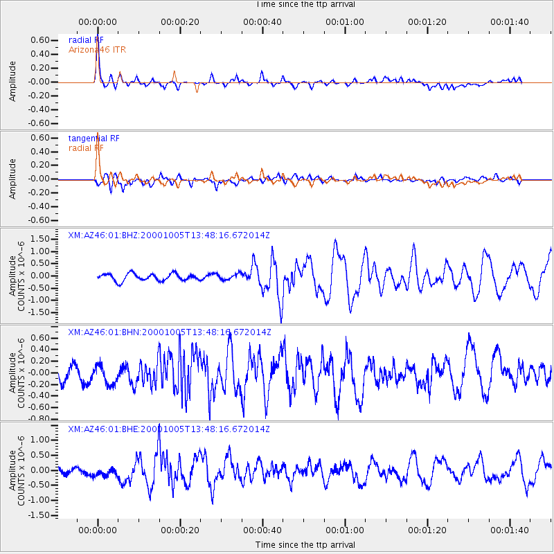
Earthquake location: Northern Mid-Atlantic Ridge
Earthquake latitude/longitude: 31.7/-41.0
Earthquake time(UTC): 2000/10/05 (279) 13:39:11 GMT
Earthquake Depth: 10 km
Earthquake Magnitude: 5.4 MB, 6.1 MS, 6.0 MW, 5.9 MW
Earthquake Catalog/Contributor: WHDF/NEIC
Network: XM Rio Grande Seismic Transect
Station: AZ46 Arizona46
Lat/Lon: 36.55 N/109.23 W
Elevation: 2009 m
Distance: 55.6 deg
Az: 295.027 deg
Baz: 73.504 deg
Ray Param: 0.06466043
Estimated Moho Depth: 65.25 km
Estimated Crust Vp/Vs: 1.89
Assumed Crust Vp: 6.476 km/s
Estimated Crust Vs: 3.431 km/s
Estimated Crust Poisson's Ratio: 0.30
Radial Match: 83.06777 %
Radial Bump: 400
Transverse Match: 66.757805 %
Transverse Bump: 400
SOD ConfigId: 16820
Insert Time: 2010-02-26 17:20:29.897 +0000
GWidth: 2.5
Max Bumps: 400
Tol: 0.001

Signal To Noise

ChannelStoNSTALTA
XM:AZ46:01:BHN:20001005T13:48:16.672014Z1.12725261.588804E-71.409448E-7
XM:AZ46:01:BHE:20001005T13:48:16.672014Z1.28950361.429572E-71.108622E-7
XM:AZ46:01:BHZ:20001005T13:48:16.672014Z0.832596961.19117644E-71.430676E-7
Arrivals
Ps9.4 SECOND
PpPs28 SECOND
PsPs/PpSs37 SECOND