AZ46 Arizona46 - Earthquake Result Viewer
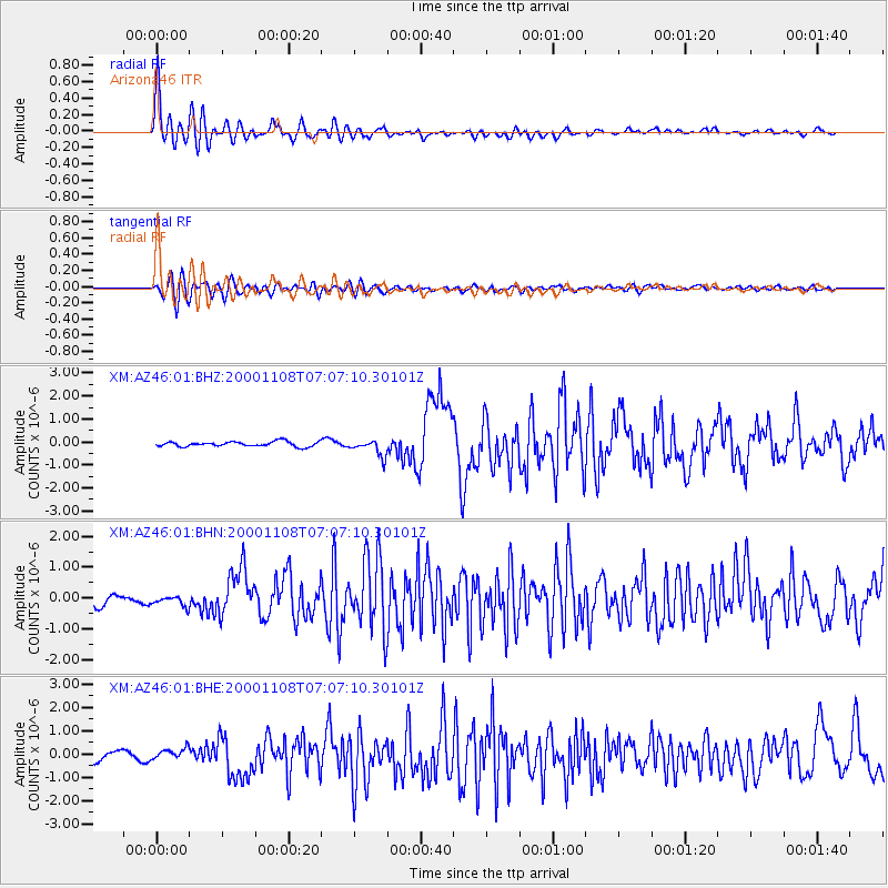
Earthquake location: Panama-Colombia Border Region
Earthquake latitude/longitude: 7.0/-77.8
Earthquake time(UTC): 2000/11/08 (313) 06:59:58 GMT
Earthquake Depth: 17 km
Earthquake Magnitude: 6.0 MB, 6.4 MS, 6.5 MW, 6.2 ML
Earthquake Catalog/Contributor: WHDF/NEIC
Network: XM Rio Grande Seismic Transect
Station: AZ46 Arizona46
Lat/Lon: 36.55 N/109.23 W
Elevation: 2009 m
Distance: 41.0 deg
Az: 320.272 deg
Baz: 128.017 deg
Ray Param: 0.07403023
Estimated Moho Depth: 48.0 km
Estimated Crust Vp/Vs: 1.68
Assumed Crust Vp: 6.476 km/s
Estimated Crust Vs: 3.86 km/s
Estimated Crust Poisson's Ratio: 0.22
Radial Match: 90.79069 %
Radial Bump: 400
Transverse Match: 74.93459 %
Transverse Bump: 400
SOD ConfigId: 16820
Insert Time: 2010-02-26 17:20:34.947 +0000
GWidth: 2.5
Max Bumps: 400
Tol: 0.001

Signal To Noise

ChannelStoNSTALTA
XM:AZ46:01:BHN:20001108T07:07:10.30101Z1.24270521.8519543E-71.4902604E-7
XM:AZ46:01:BHE:20001108T07:07:10.30101Z1.63607822.7392042E-71.6742501E-7
XM:AZ46:01:BHZ:20001108T07:07:10.30101Z3.3556953.637366E-71.0839382E-7
Arrivals
Ps5.4 SECOND
PpPs18 SECOND
PsPs/PpSs24 SECOND