AZ46 Arizona46 - Earthquake Result Viewer
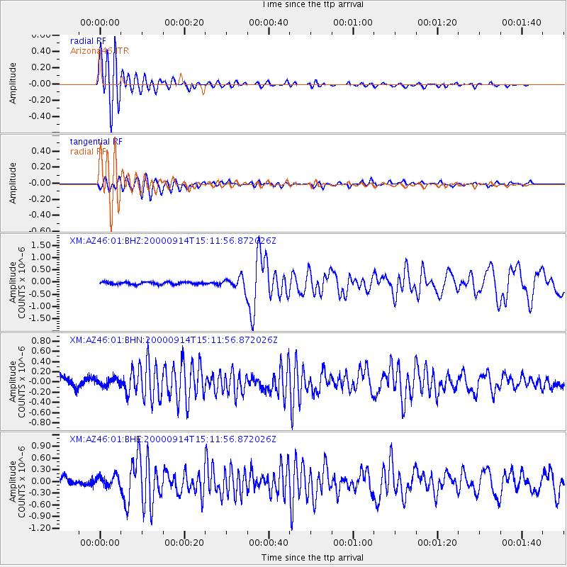
Earthquake location: Fiji Islands
Earthquake latitude/longitude: -15.7/179.8
Earthquake time(UTC): 2000/09/14 (258) 14:59:57 GMT
Earthquake Depth: 33 km
Earthquake Magnitude: 5.7 MB, 6.2 MS, 6.3 MW, 6.2 MW
Earthquake Catalog/Contributor: WHDF/NEIC
Network: XM Rio Grande Seismic Transect
Station: AZ46 Arizona46
Lat/Lon: 36.55 N/109.23 W
Elevation: 2009 m
Distance: 84.7 deg
Az: 49.866 deg
Baz: 246.106 deg
Ray Param: 0.04527554
Estimated Moho Depth: 13.0 km
Estimated Crust Vp/Vs: 1.94
Assumed Crust Vp: 6.476 km/s
Estimated Crust Vs: 3.334 km/s
Estimated Crust Poisson's Ratio: 0.32
Radial Match: 91.560425 %
Radial Bump: 400
Transverse Match: 78.063 %
Transverse Bump: 400
SOD ConfigId: 16820
Insert Time: 2010-02-26 17:20:42.093 +0000
GWidth: 2.5
Max Bumps: 400
Tol: 0.001

Signal To Noise

ChannelStoNSTALTA
XM:AZ46:01:BHN:20000914T15:11:56.872026Z0.95002918.021194E-88.4431036E-8
XM:AZ46:01:BHE:20000914T15:11:56.872026Z1.74298881.5312027E-78.784925E-8
XM:AZ46:01:BHZ:20000914T15:11:56.872026Z4.98575072.4936278E-75.0015093E-8
Arrivals
Ps1.9 SECOND
PpPs5.8 SECOND
PsPs/PpSs7.7 SECOND