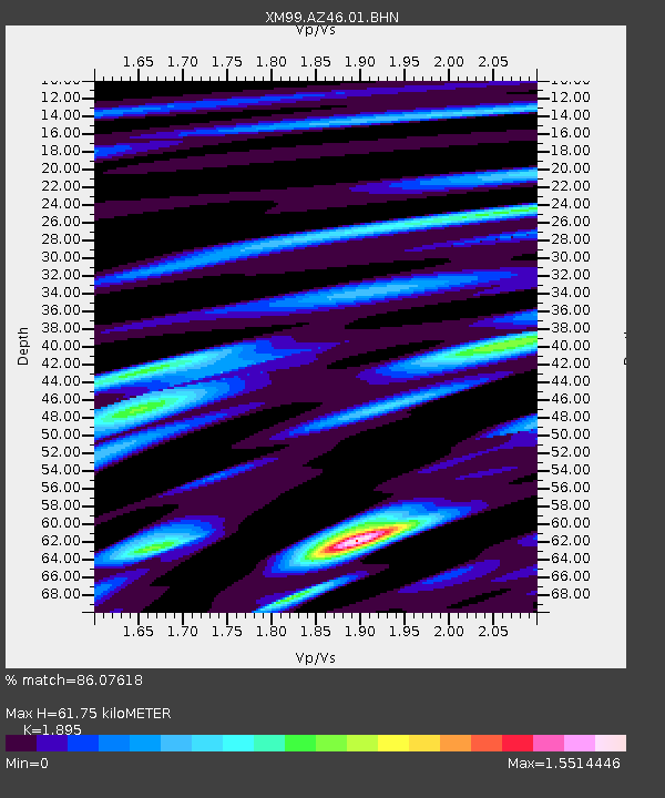
AZ46 Arizona46 - Earthquake Result Viewer
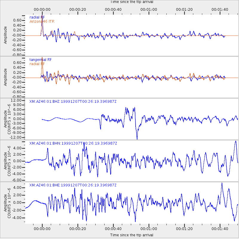
Earthquake location: Kodiak Island Region, Alaska
Earthquake latitude/longitude: 57.4/-154.5
Earthquake time(UTC): 1999/12/07 (341) 00:19:49 GMT
Earthquake Depth: 41 km
Earthquake Magnitude: 6.5 MB, 6.1 MS, 6.4 MW, 6.3 ML
Earthquake Catalog/Contributor: WHDF/NEIC
Network: XM Rio Grande Seismic Transect
Station: AZ46 Arizona46
Lat/Lon: 36.55 N/109.23 W
Elevation: 2009 m
Distance: 36.4 deg
Az: 105.141 deg
Baz: 319.488 deg
Ray Param: 0.07663593
Estimated Moho Depth: 61.75 km
Estimated Crust Vp/Vs: 1.89
Assumed Crust Vp: 6.476 km/s
Estimated Crust Vs: 3.417 km/s
Estimated Crust Poisson's Ratio: 0.31
Radial Match: 86.07618 %
Radial Bump: 400
Transverse Match: 67.431656 %
Transverse Bump: 400
SOD ConfigId: 27569
Insert Time: 2010-02-26 17:20:57.710 +0000
GWidth: 2.5
Max Bumps: 400
Tol: 0.001

Signal To Noise

ChannelStoNSTALTA
XM:AZ46:01:BHN:19991207T00:26:19.396987Z3.31442281.4497799E-64.3741548E-7
XM:AZ46:01:BHE:19991207T00:26:19.396987Z1.44685041.0932097E-67.55579E-7
XM:AZ46:01:BHZ:19991207T00:26:19.396987Z2.83140662.1310173E-67.526355E-7
Arrivals
Ps9.2 SECOND
PpPs26 SECOND
PsPs/PpSs35 SECOND