You are here: Home > Network List > XM99 - Rio Grande Seismic Transect Stations List
> Station AZ46 Arizona46 > Earthquake Result Viewer
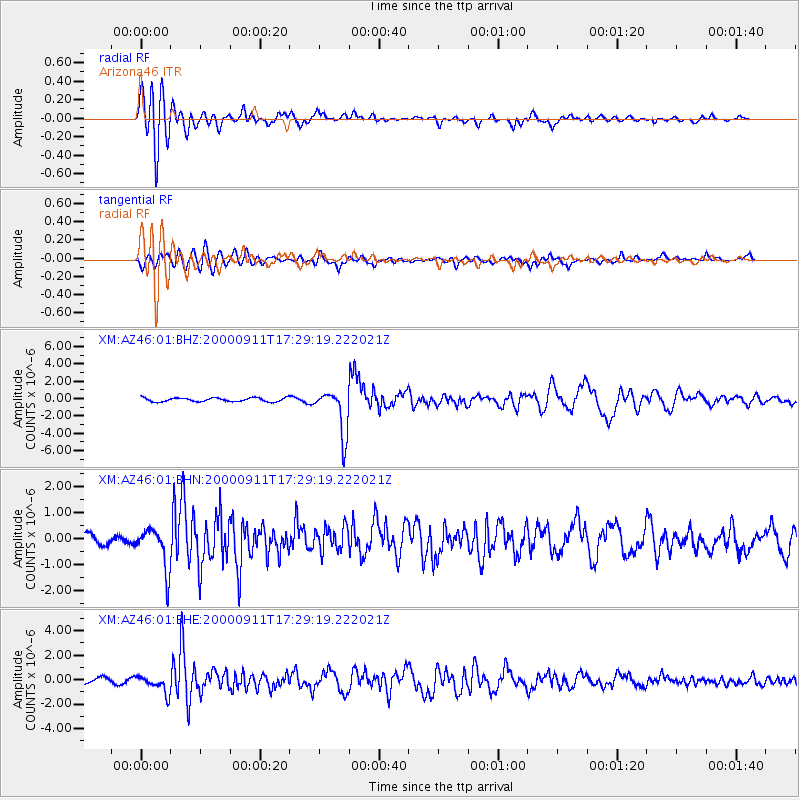
AZ46 Arizona46 - Earthquake Result Viewer
*The percent match for this event was below the threshold and hence no stack was calculated.
| Earthquake location: |
Tonga Islands |
| Earthquake latitude/longitude: |
-15.9/-173.7 |
| Earthquake time(UTC): |
2000/09/11 (255) 17:17:53 GMT |
| Earthquake Depth: |
115 km |
| Earthquake Magnitude: |
6.0 MB, 6.3 MW, 6.3 MW |
| Earthquake Catalog/Contributor: |
WHDF/NEIC |
|
| Network: |
XM Rio Grande Seismic Transect |
| Station: |
AZ46 Arizona46 |
| Lat/Lon: |
36.55 N/109.23 W |
| Elevation: |
2009 m |
|
| Distance: |
80.0 deg |
| Az: |
47.533 deg |
| Baz: |
241.833 deg |
| Ray Param: |
$rayparam |
*The percent match for this event was below the threshold and hence was not used in the summary stack. |
|
| Radial Match: |
89.41202 % |
| Radial Bump: |
400 |
| Transverse Match: |
73.97377 % |
| Transverse Bump: |
400 |
| SOD ConfigId: |
16820 |
| Insert Time: |
2010-02-26 17:21:02.160 +0000 |
| GWidth: |
2.5 |
| Max Bumps: |
400 |
| Tol: |
0.001 |
|
Signal To Noise
| Channel | StoN | STA | LTA |
| XM:AZ46:01:BHN:20000911T17:29:19.222021Z | 2.5388396 | 8.038414E-7 | 3.1661762E-7 |
| XM:AZ46:01:BHE:20000911T17:29:19.222021Z | 3.7298224 | 7.0816736E-7 | 1.8986624E-7 |
| XM:AZ46:01:BHZ:20000911T17:29:19.222021Z | 12.251448 | 2.6483292E-6 | 2.161646E-7 |
| Arrivals |
| Ps | |
| PpPs | |
| PsPs/PpSs | |


