AZ45 Arizona54 - Earthquake Result Viewer
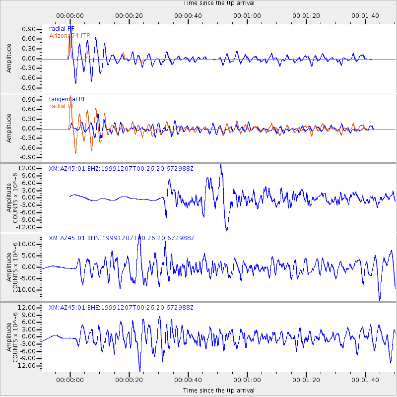
Earthquake location: Kodiak Island Region, Alaska
Earthquake latitude/longitude: 57.4/-154.5
Earthquake time(UTC): 1999/12/07 (341) 00:19:49 GMT
Earthquake Depth: 41 km
Earthquake Magnitude: 6.5 MB, 6.1 MS, 6.4 MW, 6.3 ML
Earthquake Catalog/Contributor: WHDF/NEIC
Network: XM Rio Grande Seismic Transect
Station: AZ45 Arizona54
Lat/Lon: 36.46 N/109.08 W
Elevation: 2683 m
Distance: 36.5 deg
Az: 105.094 deg
Baz: 319.537 deg
Ray Param: 0.07655444
Estimated Moho Depth: 53.25 km
Estimated Crust Vp/Vs: 2.00
Assumed Crust Vp: 6.476 km/s
Estimated Crust Vs: 3.234 km/s
Estimated Crust Poisson's Ratio: 0.33
Radial Match: 90.67357 %
Radial Bump: 351
Transverse Match: 74.25041 %
Transverse Bump: 400
SOD ConfigId: 27569
Insert Time: 2010-02-26 17:21:31.486 +0000
GWidth: 2.5
Max Bumps: 400
Tol: 0.001

Signal To Noise

ChannelStoNSTALTA
XM:AZ45:01:BHN:19991207T00:26:20.672988Z4.44192.8940235E-66.515283E-7
XM:AZ45:01:BHE:19991207T00:26:20.672988Z2.69432882.3029113E-68.547254E-7
XM:AZ45:01:BHZ:19991207T00:26:20.672988Z5.23221733.610201E-66.8999447E-7
Arrivals
Ps8.8 SECOND
PpPs23 SECOND
PsPs/PpSs32 SECOND