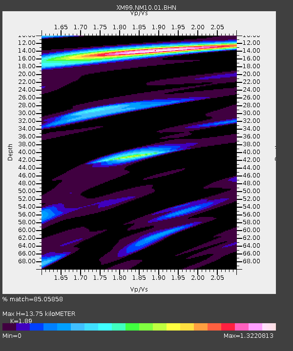
NM10 NewMexico10 - Earthquake Result Viewer
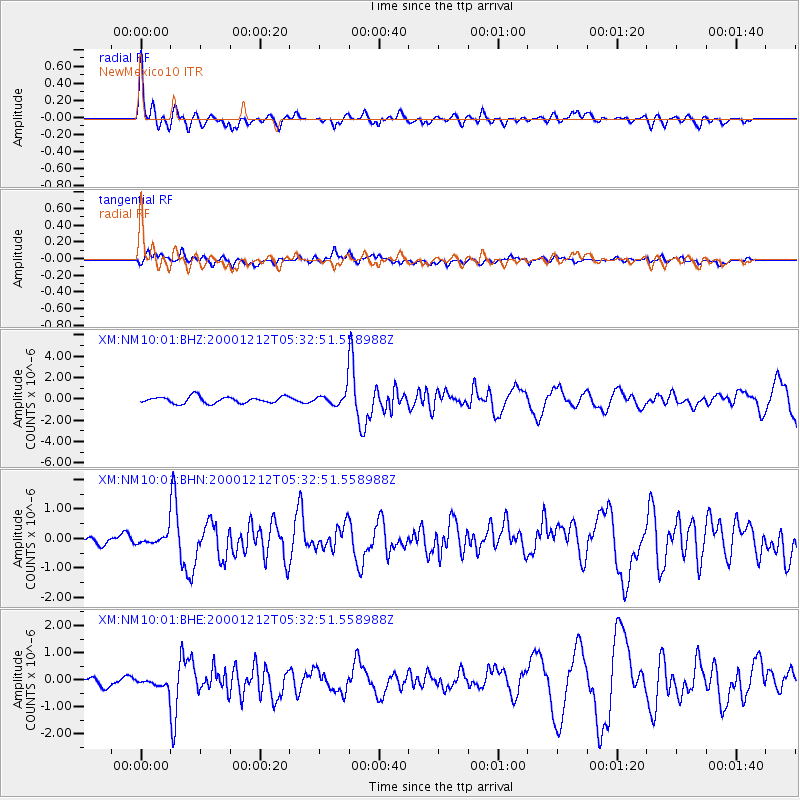
Earthquake location: South Of Panama
Earthquake latitude/longitude: 6.0/-82.7
Earthquake time(UTC): 2000/12/12 (347) 05:26:45 GMT
Earthquake Depth: 10 km
Earthquake Magnitude: 5.8 MB, 5.7 MS, 6.3 ME, 6.1 MW
Earthquake Catalog/Contributor: WHDF/NEIC
Network: XM Rio Grande Seismic Transect
Station: NM10 NewMexico10
Lat/Lon: 32.47 N/104.27 W
Elevation: 929 m
Distance: 33.1 deg
Az: 325.328 deg
Baz: 137.983 deg
Ray Param: 0.0783446
Estimated Moho Depth: 13.75 km
Estimated Crust Vp/Vs: 1.89
Assumed Crust Vp: 6.232 km/s
Estimated Crust Vs: 3.297 km/s
Estimated Crust Poisson's Ratio: 0.31
Radial Match: 85.05858 %
Radial Bump: 400
Transverse Match: 54.399906 %
Transverse Bump: 400
SOD ConfigId: 16820
Insert Time: 2010-02-26 17:21:39.815 +0000
GWidth: 2.5
Max Bumps: 400
Tol: 0.001

Signal To Noise

ChannelStoNSTALTA
XM:NM10:01:BHN:20001212T05:32:51.558988Z1.02244772.1517431E-72.1045018E-7
XM:NM10:01:BHE:20001212T05:32:51.558988Z0.96473042.1649227E-72.2440703E-7
XM:NM10:01:BHZ:20001212T05:32:51.558988Z2.17285236.675359E-73.0721642E-7
Arrivals
Ps2.1 SECOND
PpPs6.0 SECOND
PsPs/PpSs8.1 SECOND