NM10 NewMexico10 - Earthquake Result Viewer
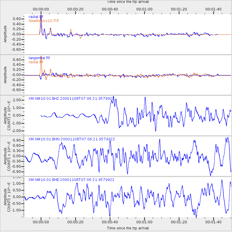
Earthquake location: Panama-Colombia Border Region
Earthquake latitude/longitude: 7.0/-77.8
Earthquake time(UTC): 2000/11/08 (313) 06:59:58 GMT
Earthquake Depth: 17 km
Earthquake Magnitude: 6.0 MB, 6.4 MS, 6.5 MW, 6.2 ML
Earthquake Catalog/Contributor: WHDF/NEIC
Network: XM Rio Grande Seismic Transect
Station: NM10 NewMexico10
Lat/Lon: 32.47 N/104.27 W
Elevation: 929 m
Distance: 35.3 deg
Az: 319.341 deg
Baz: 130.086 deg
Ray Param: 0.07728851
Estimated Moho Depth: 42.25 km
Estimated Crust Vp/Vs: 1.77
Assumed Crust Vp: 6.232 km/s
Estimated Crust Vs: 3.521 km/s
Estimated Crust Poisson's Ratio: 0.27
Radial Match: 87.133804 %
Radial Bump: 400
Transverse Match: 63.555454 %
Transverse Bump: 400
SOD ConfigId: 16820
Insert Time: 2010-02-26 17:21:40.892 +0000
GWidth: 2.5
Max Bumps: 400
Tol: 0.001

Signal To Noise

ChannelStoNSTALTA
XM:NM10:01:BHN:20001108T07:06:21.957992Z1.7473863.4719002E-71.986911E-7
XM:NM10:01:BHE:20001108T07:06:21.957992Z2.19520072.1115483E-79.618931E-8
XM:NM10:01:BHZ:20001108T07:06:21.957992Z2.5958424.3694408E-71.6832462E-7
Arrivals
Ps5.6 SECOND
PpPs17 SECOND
PsPs/PpSs23 SECOND