
NM10 NewMexico10 - Earthquake Result Viewer
| ||||||||||||||||||
| ||||||||||||||||||
| ||||||||||||||||||
|
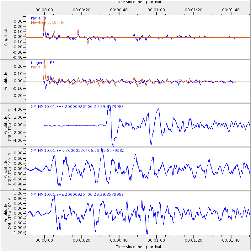
Signal To Noise
| Channel | StoN | STA | LTA |
| XM:NM10:01:BHN:20000926T06:29:39.857998Z | 1.9507203 | 2.1998315E-7 | 1.1277021E-7 |
| XM:NM10:01:BHE:20000926T06:29:39.857998Z | 4.3726826 | 3.4288735E-7 | 7.841579E-8 |
| XM:NM10:01:BHZ:20000926T06:29:39.857998Z | 26.377304 | 1.9934878E-6 | 7.5575876E-8 |
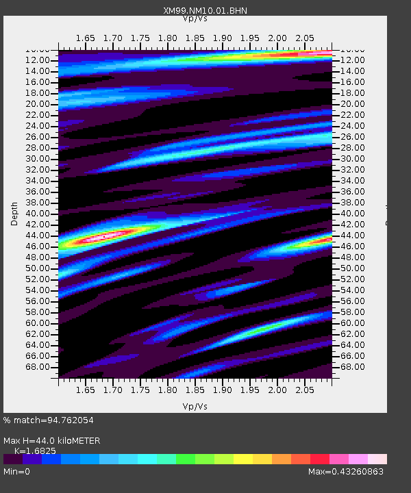
| Arrivals | |
| Ps | 4.9 SECOND |
| PpPs | 18 SECOND |
| PsPs/PpSs | 23 SECOND |

