NM10 NewMexico10 - Earthquake Result Viewer
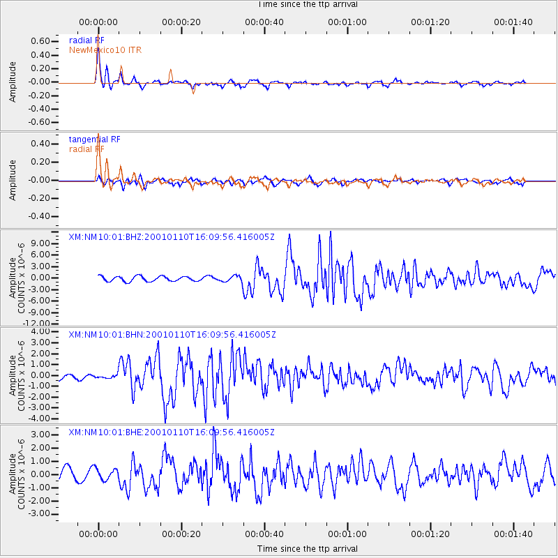
Earthquake location: Kodiak Island Region, Alaska
Earthquake latitude/longitude: 57.1/-153.2
Earthquake time(UTC): 2001/01/10 (010) 16:02:44 GMT
Earthquake Depth: 33 km
Earthquake Magnitude: 6.2 MB, 6.8 MS, 7.1 MW, 6.8 ML
Earthquake Catalog/Contributor: WHDF/NEIC
Network: XM Rio Grande Seismic Transect
Station: NM10 NewMexico10
Lat/Lon: 32.47 N/104.27 W
Elevation: 929 m
Distance: 41.3 deg
Az: 105.211 deg
Baz: 321.435 deg
Ray Param: 0.073785886
Estimated Moho Depth: 11.75 km
Estimated Crust Vp/Vs: 2.03
Assumed Crust Vp: 6.232 km/s
Estimated Crust Vs: 3.074 km/s
Estimated Crust Poisson's Ratio: 0.34
Radial Match: 90.23874 %
Radial Bump: 349
Transverse Match: 67.94969 %
Transverse Bump: 400
SOD ConfigId: 3744
Insert Time: 2010-02-26 17:21:45.422 +0000
GWidth: 2.5
Max Bumps: 400
Tol: 0.001

Signal To Noise

ChannelStoNSTALTA
XM:NM10:01:BHN:20010110T16:09:56.416005Z0.39338641.909369E-74.853673E-7
XM:NM10:01:BHE:20010110T16:09:56.416005Z0.88922723.986548E-74.4831603E-7
XM:NM10:01:BHZ:20010110T16:09:56.416005Z1.2981668.399609E-76.4703653E-7
Arrivals
Ps2.0 SECOND
PpPs5.4 SECOND
PsPs/PpSs7.4 SECOND