
NM10 NewMexico10 - Earthquake Result Viewer
| ||||||||||||||||||
| ||||||||||||||||||
| ||||||||||||||||||
|
Signal To Noise
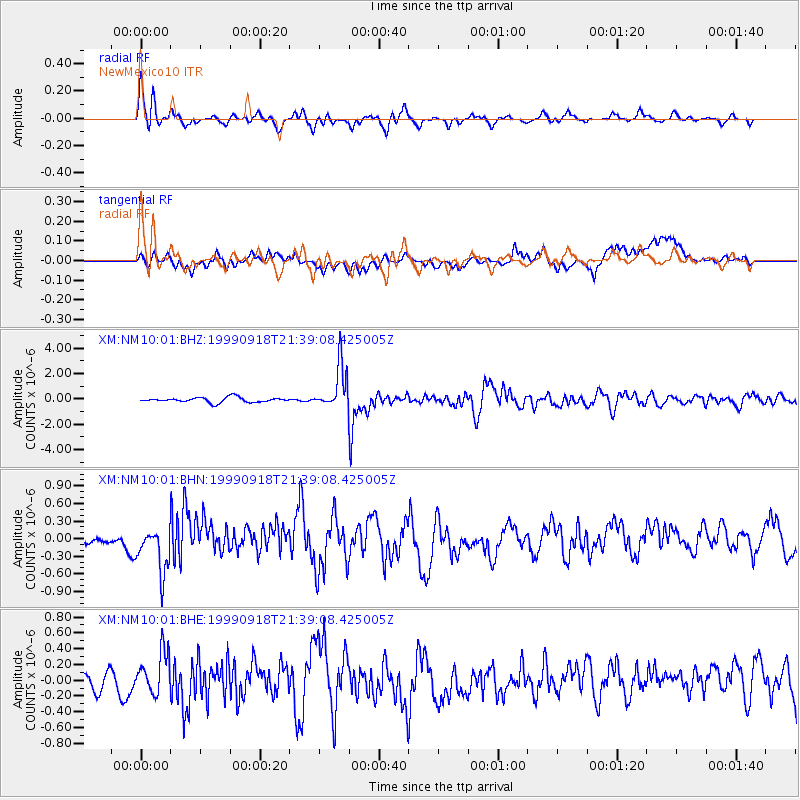
| Channel | StoN | STA | LTA |
| XM:NM10:01:BHN:19990918T21:39:08.425005Z | 4.7009153 | 3.5862035E-7 | 7.628735E-8 |
| XM:NM10:01:BHE:19990918T21:39:08.425005Z | 2.57795 | 2.7997297E-7 | 1.0860295E-7 |
| XM:NM10:01:BHZ:19990918T21:39:08.425005Z | 8.858998 | 1.7363526E-6 | 1.9599875E-7 |
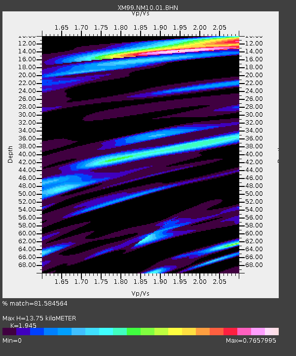
| Arrivals | |
| Ps | 2.2 SECOND |
| PpPs | 6.3 SECOND |
| PsPs/PpSs | 8.4 SECOND |

