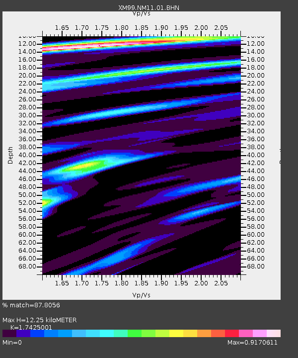
NM11 NewMexico11 - Earthquake Result Viewer
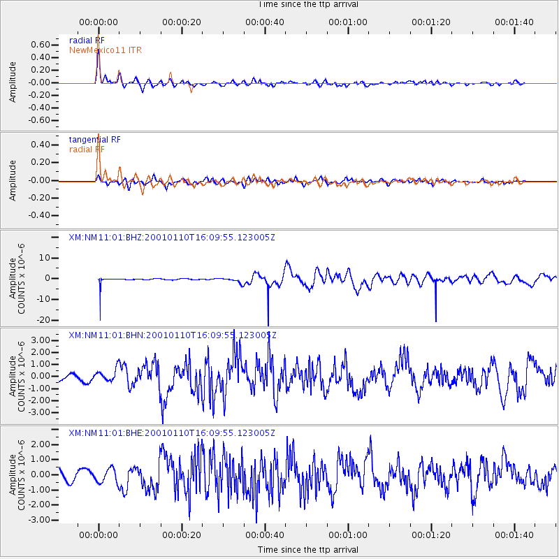
Earthquake location: Kodiak Island Region, Alaska
Earthquake latitude/longitude: 57.1/-153.2
Earthquake time(UTC): 2001/01/10 (010) 16:02:44 GMT
Earthquake Depth: 33 km
Earthquake Magnitude: 6.2 MB, 6.8 MS, 7.1 MW, 6.8 ML
Earthquake Catalog/Contributor: WHDF/NEIC
Network: XM Rio Grande Seismic Transect
Station: NM11 NewMexico11
Lat/Lon: 32.58 N/104.41 W
Elevation: 974 m
Distance: 41.2 deg
Az: 105.248 deg
Baz: 321.388 deg
Ray Param: 0.073886886
Estimated Moho Depth: 12.25 km
Estimated Crust Vp/Vs: 1.74
Assumed Crust Vp: 6.232 km/s
Estimated Crust Vs: 3.576 km/s
Estimated Crust Poisson's Ratio: 0.25
Radial Match: 87.8056 %
Radial Bump: 400
Transverse Match: 75.459915 %
Transverse Bump: 400
SOD ConfigId: 3744
Insert Time: 2010-02-26 17:22:00.817 +0000
GWidth: 2.5
Max Bumps: 400
Tol: 0.001

Signal To Noise

ChannelStoNSTALTA
XM:NM11:01:BHN:20010110T16:09:55.123005Z2.26523575.323744E-72.3501943E-7
XM:NM11:01:BHE:20010110T16:09:55.123005Z1.73864544.814156E-72.768912E-7
XM:NM11:01:BHZ:20010110T16:09:55.123005Z1.0714311.2692619E-61.1846417E-6
Arrivals
Ps1.6 SECOND
PpPs5.0 SECOND
PsPs/PpSs6.6 SECOND