NM07 NewMexico07 - Earthquake Result Viewer
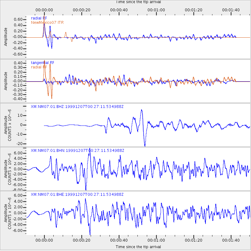
Earthquake location: Kodiak Island Region, Alaska
Earthquake latitude/longitude: 57.4/-154.5
Earthquake time(UTC): 1999/12/07 (341) 00:19:49 GMT
Earthquake Depth: 41 km
Earthquake Magnitude: 6.5 MB, 6.1 MS, 6.4 MW, 6.3 ML
Earthquake Catalog/Contributor: WHDF/NEIC
Network: XM Rio Grande Seismic Transect
Station: NM07 NewMexico07
Lat/Lon: 32.08 N/103.84 W
Elevation: 966 m
Distance: 42.6 deg
Az: 104.16 deg
Baz: 321.758 deg
Ray Param: 0.072969496
Estimated Moho Depth: 22.75 km
Estimated Crust Vp/Vs: 1.83
Assumed Crust Vp: 6.129 km/s
Estimated Crust Vs: 3.354 km/s
Estimated Crust Poisson's Ratio: 0.29
Radial Match: 80.714584 %
Radial Bump: 400
Transverse Match: 52.607212 %
Transverse Bump: 400
SOD ConfigId: 27569
Insert Time: 2010-02-26 17:22:44.466 +0000
GWidth: 2.5
Max Bumps: 400
Tol: 0.001

Signal To Noise

ChannelStoNSTALTA
XM:NM07:01:BHN:19991207T00:27:11.534988Z2.58735511.8741528E-67.2435085E-7
XM:NM07:01:BHE:19991207T00:27:11.534988Z1.12798199.4571334E-78.3841184E-7
XM:NM07:01:BHZ:19991207T00:27:11.534988Z7.15138773.8259986E-65.350009E-7
Arrivals
Ps3.3 SECOND
PpPs9.9 SECOND
PsPs/PpSs13 SECOND