You are here: Home > Network List > XM99 - Rio Grande Seismic Transect Stations List
> Station NM07 NewMexico07 > Earthquake Result Viewer
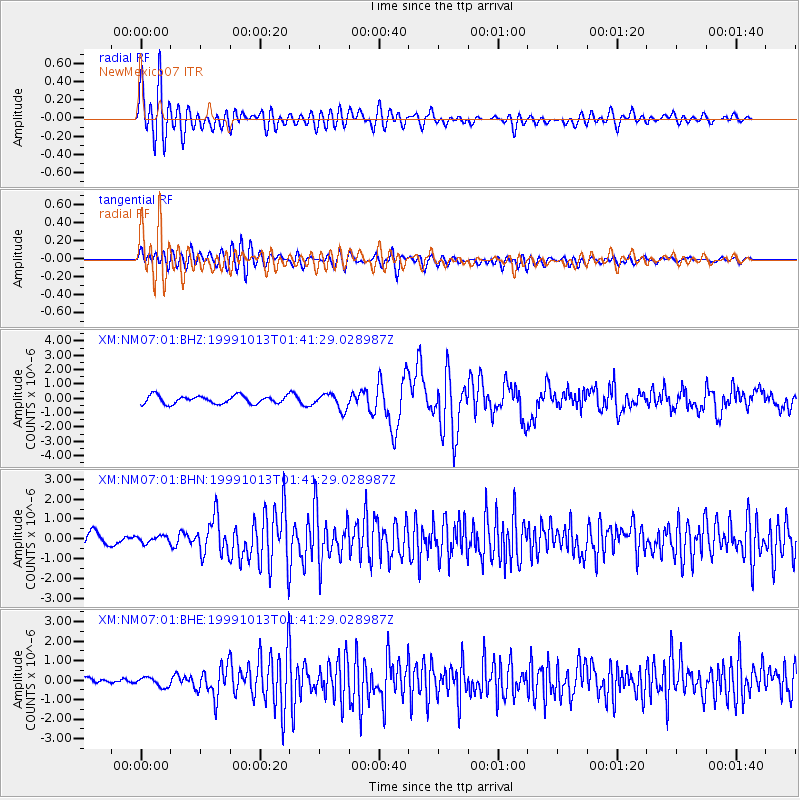
NM07 NewMexico07 - Earthquake Result Viewer
*The percent match for this event was below the threshold and hence no stack was calculated.
| Earthquake location: |
Alaska Peninsula |
| Earthquake latitude/longitude: |
54.7/-161.2 |
| Earthquake time(UTC): |
1999/10/13 (286) 01:33:40 GMT |
| Earthquake Depth: |
30 km |
| Earthquake Magnitude: |
6.0 MB, 6.2 MS, 6.5 MW, 6.0 ML |
| Earthquake Catalog/Contributor: |
WHDF/NEIC |
|
| Network: |
XM Rio Grande Seismic Transect |
| Station: |
NM07 NewMexico07 |
| Lat/Lon: |
32.08 N/103.84 W |
| Elevation: |
966 m |
|
| Distance: |
45.9 deg |
| Az: |
95.243 deg |
| Baz: |
317.028 deg |
| Ray Param: |
$rayparam |
*The percent match for this event was below the threshold and hence was not used in the summary stack. |
|
| Radial Match: |
86.47362 % |
| Radial Bump: |
400 |
| Transverse Match: |
74.0064 % |
| Transverse Bump: |
400 |
| SOD ConfigId: |
27569 |
| Insert Time: |
2010-02-26 17:22:48.023 +0000 |
| GWidth: |
2.5 |
| Max Bumps: |
400 |
| Tol: |
0.001 |
|
Signal To Noise
| Channel | StoN | STA | LTA |
| XM:NM07:01:BHN:19991013T01:41:29.028987Z | 0.72589666 | 1.7730608E-7 | 2.4425802E-7 |
| XM:NM07:01:BHE:19991013T01:41:29.028987Z | 1.1718807 | 2.433815E-7 | 2.0768452E-7 |
| XM:NM07:01:BHZ:19991013T01:41:29.028987Z | 1.9783481 | 5.53724E-7 | 2.798921E-7 |
| Arrivals |
| Ps | |
| PpPs | |
| PsPs/PpSs | |


