NM20 NewMexico20 - Earthquake Result Viewer
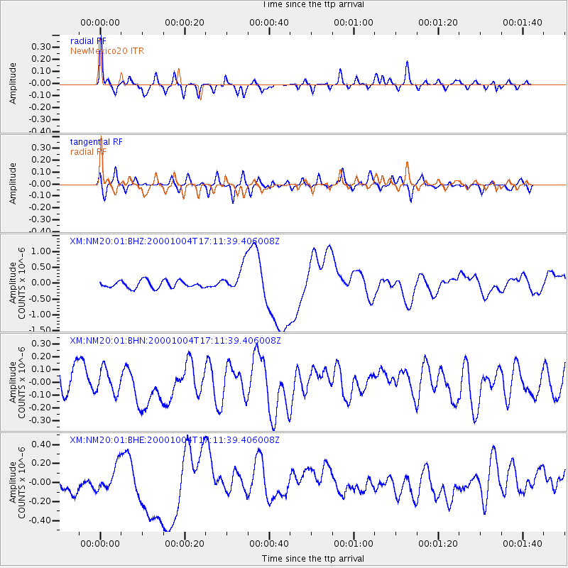
Earthquake location: Vanuatu Islands
Earthquake latitude/longitude: -15.4/166.9
Earthquake time(UTC): 2000/10/04 (278) 16:58:44 GMT
Earthquake Depth: 23 km
Earthquake Magnitude: 6.1 MB, 6.9 MS, 6.8 MW, 6.5 ME
Earthquake Catalog/Contributor: WHDF/NEIC
Network: XM Rio Grande Seismic Transect
Station: NM20 NewMexico20
Lat/Lon: 33.60 N/105.59 W
Elevation: 2034 m
Distance: 96.3 deg
Az: 57.026 deg
Baz: 255.803 deg
Ray Param: 0.040535238
Estimated Moho Depth: 39.25 km
Estimated Crust Vp/Vs: 1.87
Assumed Crust Vp: 6.232 km/s
Estimated Crust Vs: 3.332 km/s
Estimated Crust Poisson's Ratio: 0.30
Radial Match: 83.65492 %
Radial Bump: 400
Transverse Match: 68.41537 %
Transverse Bump: 400
SOD ConfigId: 16820
Insert Time: 2010-02-26 17:23:11.178 +0000
GWidth: 2.5
Max Bumps: 400
Tol: 0.001

Signal To Noise

ChannelStoNSTALTA
XM:NM20:01:BHN:20001004T17:11:39.406008Z0.67567979.7898706E-81.4488923E-7
XM:NM20:01:BHE:20001004T17:11:39.406008Z1.34892671.465465E-71.0863934E-7
XM:NM20:01:BHZ:20001004T17:11:39.406008Z4.0467914.5800226E-71.13176654E-7
Arrivals
Ps5.6 SECOND
PpPs18 SECOND
PsPs/PpSs23 SECOND