NM20 NewMexico20 - Earthquake Result Viewer
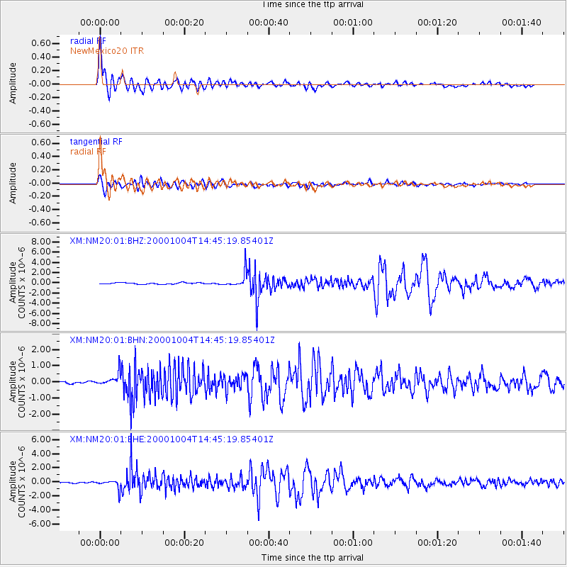
Earthquake location: Windward Islands
Earthquake latitude/longitude: 11.1/-62.6
Earthquake time(UTC): 2000/10/04 (278) 14:37:44 GMT
Earthquake Depth: 110 km
Earthquake Magnitude: 5.6 MB, 5.4 MS, 6.1 MW, 5.9 MD
Earthquake Catalog/Contributor: WHDF/NEIC
Network: XM Rio Grande Seismic Transect
Station: NM20 NewMexico20
Lat/Lon: 33.60 N/105.59 W
Elevation: 2034 m
Distance: 45.2 deg
Az: 306.648 deg
Baz: 109.35 deg
Ray Param: 0.07102567
Estimated Moho Depth: 15.75 km
Estimated Crust Vp/Vs: 2.10
Assumed Crust Vp: 6.232 km/s
Estimated Crust Vs: 2.971 km/s
Estimated Crust Poisson's Ratio: 0.35
Radial Match: 95.33189 %
Radial Bump: 400
Transverse Match: 88.517914 %
Transverse Bump: 400
SOD ConfigId: 16820
Insert Time: 2010-02-26 17:23:12.522 +0000
GWidth: 2.5
Max Bumps: 400
Tol: 0.001

Signal To Noise

ChannelStoNSTALTA
XM:NM20:01:BHN:20001004T14:45:19.85401Z5.4120234.1408978E-77.651294E-8
XM:NM20:01:BHE:20001004T14:45:19.85401Z4.9750386.534219E-71.3134009E-7
XM:NM20:01:BHZ:20001004T14:45:19.85401Z10.7487531.5304754E-61.4238633E-7
Arrivals
Ps2.9 SECOND
PpPs7.4 SECOND
PsPs/PpSs10 SECOND