You are here: Home > Network List > XM99 - Rio Grande Seismic Transect Stations List
> Station NM20 NewMexico20 > Earthquake Result Viewer
NM20 NewMexico20 - Earthquake Result Viewer

| Earthquake location: |
Northern Chile |
| Earthquake latitude/longitude: |
-18.9/-69.2 |
| Earthquake time(UTC): |
1999/11/30 (334) 04:01:53 GMT |
| Earthquake Depth: |
128 km |
| Earthquake Magnitude: |
6.2 MB, 6.6 MW, 6.5 MW |
| Earthquake Catalog/Contributor: |
WHDF/NEIC |
|
| Network: |
XM Rio Grande Seismic Transect |
| Station: |
NM20 NewMexico20 |
| Lat/Lon: |
33.60 N/105.59 W |
| Elevation: |
2034 m |
|
| Distance: |
62.7 deg |
| Az: |
326.113 deg |
| Baz: |
140.766 deg |
| Ray Param: |
0.059680432 |
| Estimated Moho Depth: |
34.0 km |
| Estimated Crust Vp/Vs: |
1.61 |
| Assumed Crust Vp: |
6.232 km/s |
| Estimated Crust Vs: |
3.883 km/s |
| Estimated Crust Poisson's Ratio: |
0.18 |
|
| Radial Match: |
84.983185 % |
| Radial Bump: |
400 |
| Transverse Match: |
60.288235 % |
| Transverse Bump: |
400 |
| SOD ConfigId: |
27569 |
| Insert Time: |
2010-02-26 17:23:17.170 +0000 |
| GWidth: |
2.5 |
| Max Bumps: |
400 |
| Tol: |
0.001 |
|
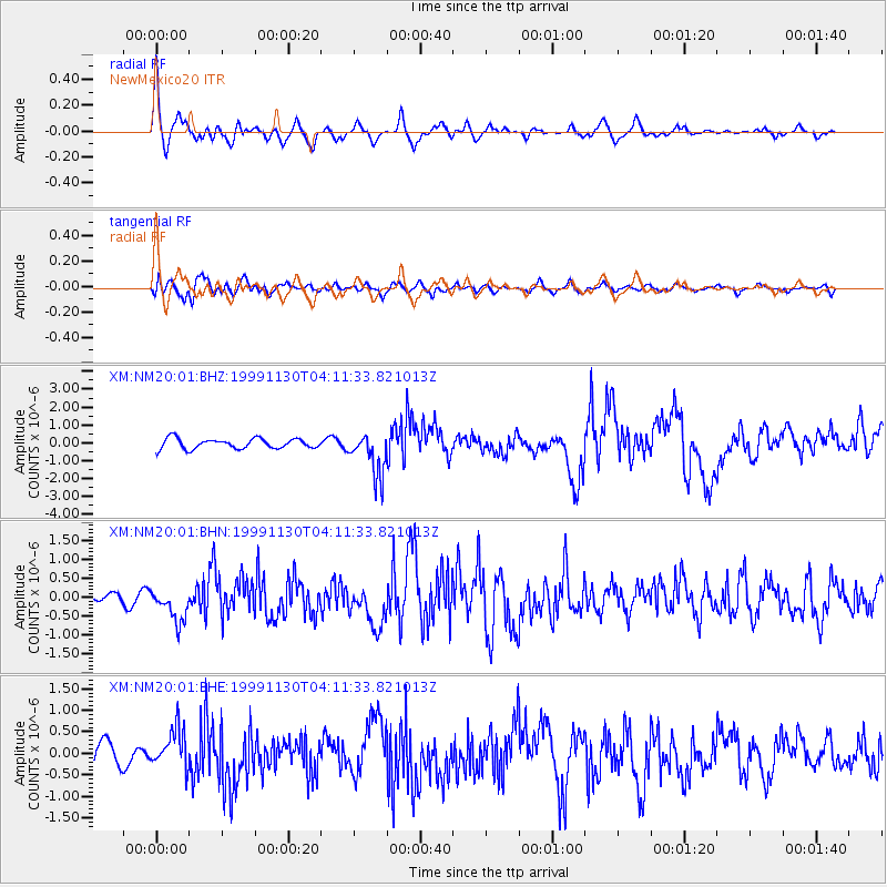
Signal To Noise
| Channel | StoN | STA | LTA |
| XM:NM20:01:BHN:19991130T04:11:33.821013Z | 3.702928 | 4.4581995E-7 | 1.203966E-7 |
| XM:NM20:01:BHE:19991130T04:11:33.821013Z | 1.7445979 | 4.5830802E-7 | 2.6270123E-7 |
| XM:NM20:01:BHZ:19991130T04:11:33.821013Z | 4.352326 | 1.2167991E-6 | 2.7957446E-7 |
| Arrivals |
| Ps | 3.5 SECOND |
| PpPs | 14 SECOND |
| PsPs/PpSs | 17 SECOND |


