You are here: Home > Network List > XM99 - Rio Grande Seismic Transect Stations List
> Station NM20 NewMexico20 > Earthquake Result Viewer
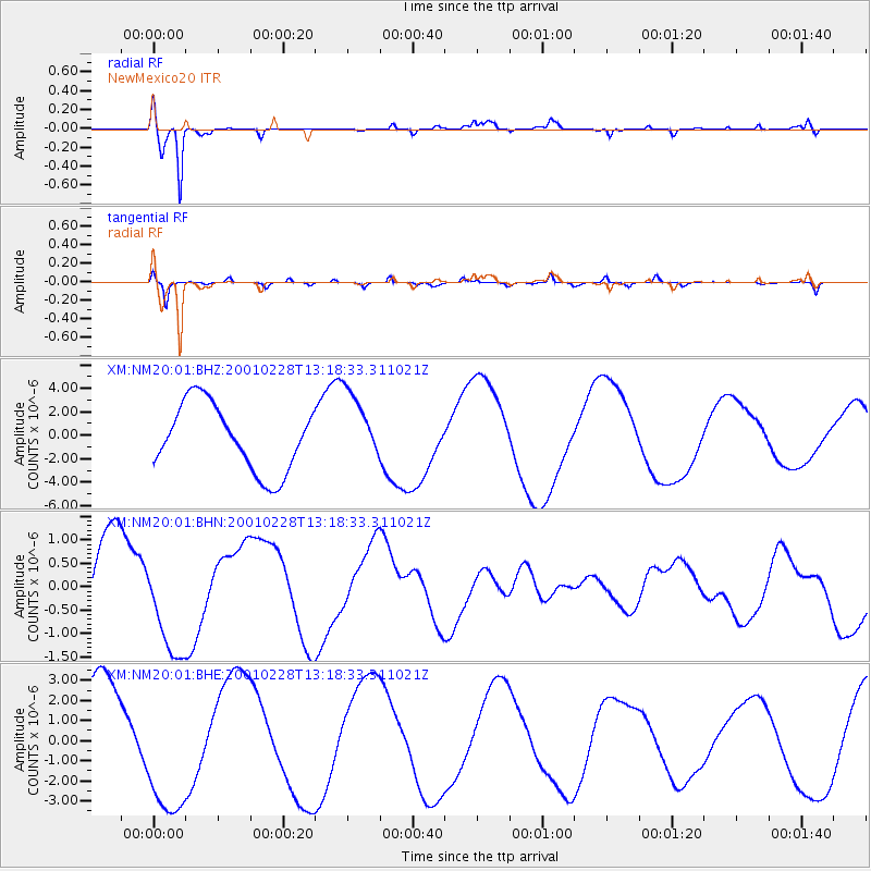
NM20 NewMexico20 - Earthquake Result Viewer
*The percent match for this event was below the threshold and hence no stack was calculated.
| Earthquake location: |
Southeast Of Loyalty Islands |
| Earthquake latitude/longitude: |
-22.0/170.1 |
| Earthquake time(UTC): |
2001/02/28 (059) 13:05:31 GMT |
| Earthquake Depth: |
10 km |
| Earthquake Magnitude: |
5.8 MB, 6.1 MS, 6.2 MW |
| Earthquake Catalog/Contributor: |
WHDF/NEIC |
|
| Network: |
XM Rio Grande Seismic Transect |
| Station: |
NM20 NewMexico20 |
| Lat/Lon: |
33.60 N/105.59 W |
| Elevation: |
2034 m |
|
| Distance: |
97.4 deg |
| Az: |
56.863 deg |
| Baz: |
248.613 deg |
| Ray Param: |
$rayparam |
*The percent match for this event was below the threshold and hence was not used in the summary stack. |
|
| Radial Match: |
93.56674 % |
| Radial Bump: |
353 |
| Transverse Match: |
77.1305 % |
| Transverse Bump: |
400 |
| SOD ConfigId: |
3744 |
| Insert Time: |
2010-02-26 17:23:25.000 +0000 |
| GWidth: |
2.5 |
| Max Bumps: |
400 |
| Tol: |
0.001 |
|
Signal To Noise
| Channel | StoN | STA | LTA |
| XM:NM20:01:BHN:20010228T13:18:33.311021Z | 1.3321861 | 1.2213713E-6 | 9.168174E-7 |
| XM:NM20:01:BHE:20010228T13:18:33.311021Z | 1.4591956 | 3.5897096E-6 | 2.4600606E-6 |
| XM:NM20:01:BHZ:20010228T13:18:33.311021Z | 1.0736932 | 3.0491815E-6 | 2.8399004E-6 |
| Arrivals |
| Ps | |
| PpPs | |
| PsPs/PpSs | |


