You are here: Home > Network List > XM99 - Rio Grande Seismic Transect Stations List
> Station NM21 NewMexico21 > Earthquake Result Viewer
NM21 NewMexico21 - Earthquake Result Viewer
*The percent match for this event was below the threshold and hence no stack was calculated.
| Earthquake location: |
Southeast Of Loyalty Islands |
| Earthquake latitude/longitude: |
-22.0/170.1 |
| Earthquake time(UTC): |
2001/02/28 (059) 13:05:31 GMT |
| Earthquake Depth: |
10 km |
| Earthquake Magnitude: |
5.8 MB, 6.1 MS, 6.2 MW |
| Earthquake Catalog/Contributor: |
WHDF/NEIC |
|
| Network: |
XM Rio Grande Seismic Transect |
| Station: |
NM21 NewMexico21 |
| Lat/Lon: |
33.73 N/105.74 W |
| Elevation: |
2000 m |
|
| Distance: |
97.3 deg |
| Az: |
56.697 deg |
| Baz: |
248.551 deg |
| Ray Param: |
$rayparam |
*The percent match for this event was below the threshold and hence was not used in the summary stack. |
|
| Radial Match: |
96.23421 % |
| Radial Bump: |
272 |
| Transverse Match: |
74.371284 % |
| Transverse Bump: |
400 |
| SOD ConfigId: |
3744 |
| Insert Time: |
2010-02-26 17:23:28.600 +0000 |
| GWidth: |
2.5 |
| Max Bumps: |
400 |
| Tol: |
0.001 |
|
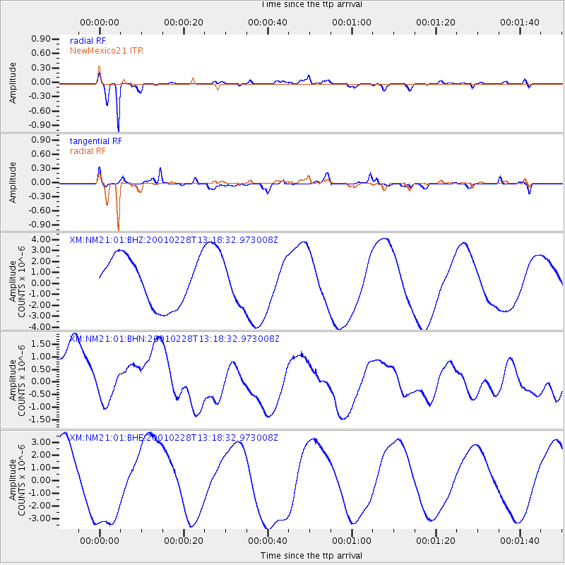
Signal To Noise
| Channel | StoN | STA | LTA |
| XM:NM21:01:BHN:20010228T13:18:32.973008Z | 0.395016 | 5.204718E-7 | 1.3175968E-6 |
| XM:NM21:01:BHE:20010228T13:18:32.973008Z | 1.367647 | 3.397303E-6 | 2.4840497E-6 |
| XM:NM21:01:BHZ:20010228T13:18:32.973008Z | 0.84742963 | 1.8261726E-6 | 2.154955E-6 |
| Arrivals |
| Ps | |
| PpPs | |
| PsPs/PpSs | |


