NM22 NewMexico22 - Earthquake Result Viewer
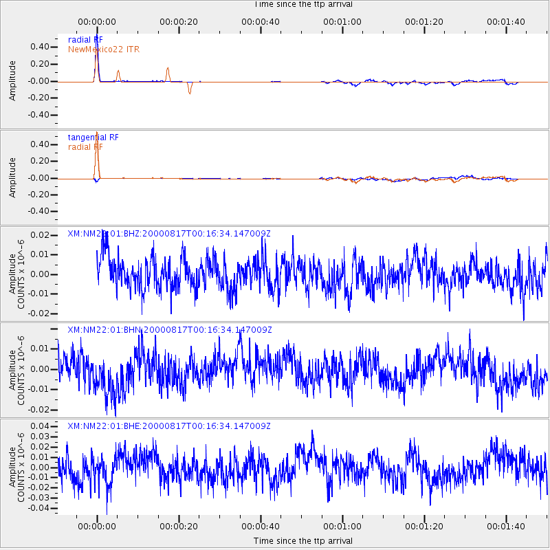
Earthquake location: Tonga Islands
Earthquake latitude/longitude: -21.9/-174.8
Earthquake time(UTC): 2000/08/17 (230) 00:04:29 GMT
Earthquake Depth: 33 km
Earthquake Magnitude: 5.4 MB, 5.8 MS, 5.9 MW, 5.7 MW
Earthquake Catalog/Contributor: WHDF/NEIC
Network: XM Rio Grande Seismic Transect
Station: NM22 NewMexico22
Lat/Lon: 33.84 N/105.87 W
Elevation: 1691 m
Distance: 85.8 deg
Az: 51.131 deg
Baz: 240.312 deg
Ray Param: 0.044439364
Estimated Moho Depth: 65.25 km
Estimated Crust Vp/Vs: 2.01
Assumed Crust Vp: 6.232 km/s
Estimated Crust Vs: 3.108 km/s
Estimated Crust Poisson's Ratio: 0.33
Radial Match: 85.76835 %
Radial Bump: 182
Transverse Match: 34.635452 %
Transverse Bump: 327
SOD ConfigId: 16820
Insert Time: 2010-02-26 17:23:33.257 +0000
GWidth: 2.5
Max Bumps: 400
Tol: 0.001

Signal To Noise

ChannelStoNSTALTA
XM:NM22:01:BHN:20000817T00:16:34.147009Z1.83812741.1810743E-86.425421E-9
XM:NM22:01:BHE:20000817T00:16:34.147009Z1.14523271.3497465E-81.1785785E-8
XM:NM22:01:BHZ:20000817T00:16:34.147009Z1.04671148.266264E-97.897366E-9
Arrivals
Ps11 SECOND
PpPs31 SECOND
PsPs/PpSs42 SECOND