NM22 NewMexico22 - Earthquake Result Viewer
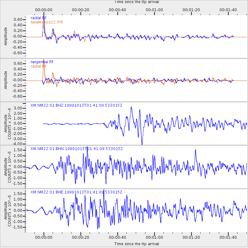
Earthquake location: Alaska Peninsula
Earthquake latitude/longitude: 54.7/-161.2
Earthquake time(UTC): 1999/10/13 (286) 01:33:40 GMT
Earthquake Depth: 30 km
Earthquake Magnitude: 6.0 MB, 6.2 MS, 6.5 MW, 6.0 ML
Earthquake Catalog/Contributor: WHDF/NEIC
Network: XM Rio Grande Seismic Transect
Station: NM22 NewMexico22
Lat/Lon: 33.84 N/105.87 W
Elevation: 1691 m
Distance: 43.4 deg
Az: 95.288 deg
Baz: 315.961 deg
Ray Param: 0.07250425
Estimated Moho Depth: 40.0 km
Estimated Crust Vp/Vs: 1.73
Assumed Crust Vp: 6.232 km/s
Estimated Crust Vs: 3.602 km/s
Estimated Crust Poisson's Ratio: 0.25
Radial Match: 86.78792 %
Radial Bump: 400
Transverse Match: 70.64998 %
Transverse Bump: 400
SOD ConfigId: 27569
Insert Time: 2010-02-26 17:23:55.456 +0000
GWidth: 2.5
Max Bumps: 400
Tol: 0.001

Signal To Noise

ChannelStoNSTALTA
XM:NM22:01:BHN:19991013T01:41:09.533015Z1.15388821.3810386E-71.1968565E-7
XM:NM22:01:BHE:19991013T01:41:09.533015Z1.50514852.0690486E-71.3746474E-7
XM:NM22:01:BHZ:19991013T01:41:09.533015Z4.72885852.9575997E-76.254363E-8
Arrivals
Ps5.0 SECOND
PpPs16 SECOND
PsPs/PpSs21 SECOND