
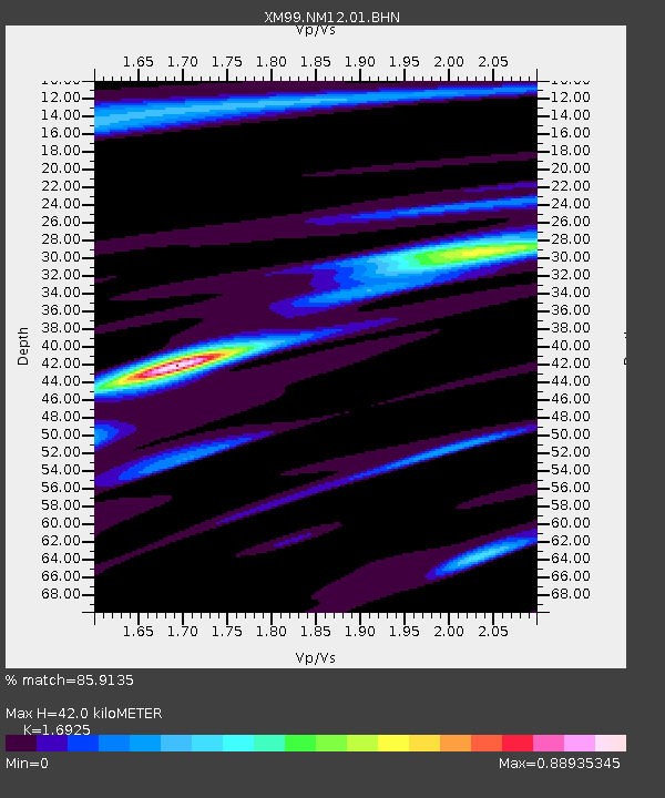
NM12 NewMexico12 - Earthquake Result Viewer
| ||||||||||||||||||
| ||||||||||||||||||
| ||||||||||||||||||
|
Signal To Noise
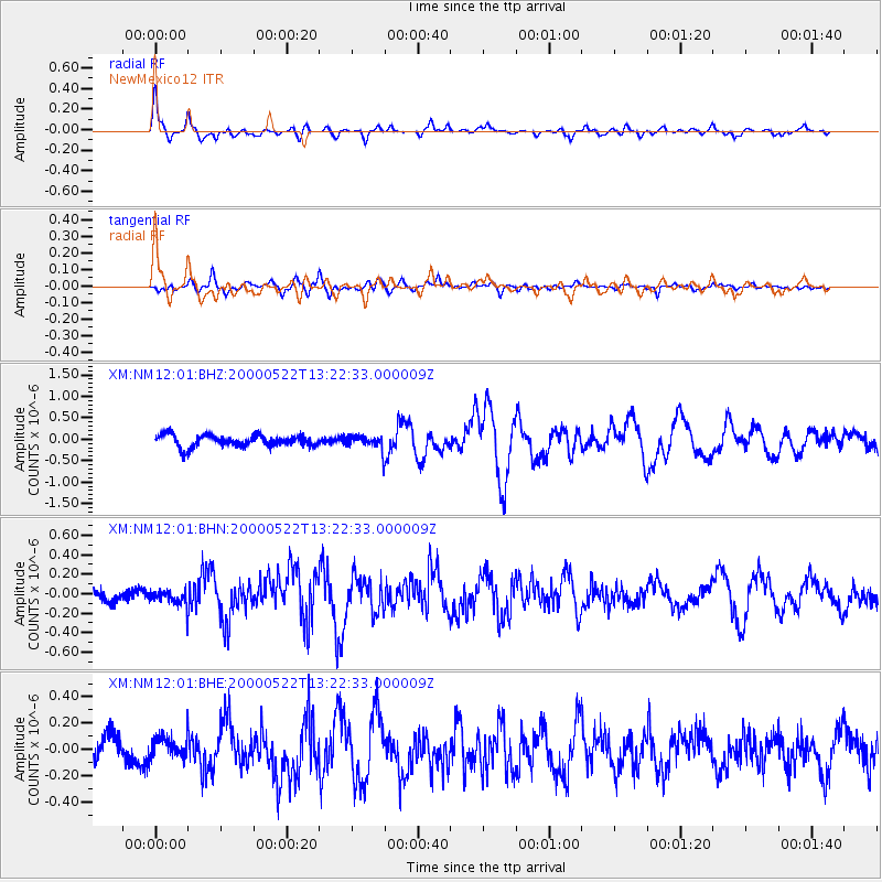
| Channel | StoN | STA | LTA |
| XM:NM12:01:BHN:20000522T13:22:33.000009Z | 1.1193506 | 7.831698E-8 | 6.996645E-8 |
| XM:NM12:01:BHE:20000522T13:22:33.000009Z | 0.99393904 | 8.727439E-8 | 8.780658E-8 |
| XM:NM12:01:BHZ:20000522T13:22:33.000009Z | 1.2097815 | 1.6611533E-7 | 1.373102E-7 |
| Arrivals | |
| Ps | 5.0 SECOND |
| PpPs | 17 SECOND |
| PsPs/PpSs | 22 SECOND |

