
NM12 NewMexico12 - Earthquake Result Viewer
| ||||||||||||||||||
| ||||||||||||||||||
| ||||||||||||||||||
|
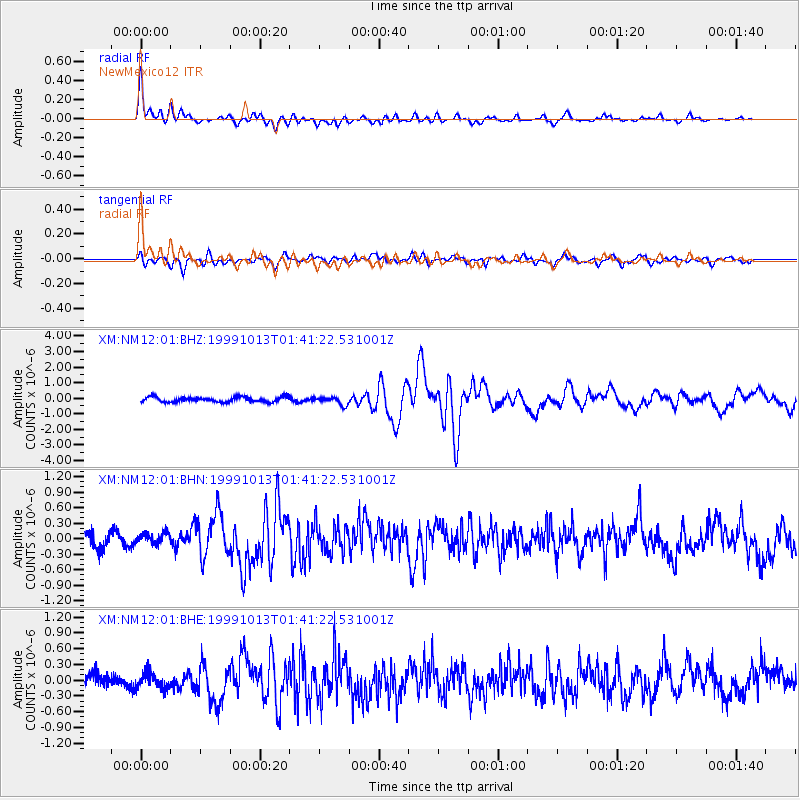
Signal To Noise
| Channel | StoN | STA | LTA |
| XM:NM12:01:BHN:19991013T01:41:22.531001Z | 0.74866015 | 1.1312559E-7 | 1.5110406E-7 |
| XM:NM12:01:BHE:19991013T01:41:22.531001Z | 0.9949581 | 1.4597248E-7 | 1.4671218E-7 |
| XM:NM12:01:BHZ:19991013T01:41:22.531001Z | 1.603785 | 2.5626386E-7 | 1.5978691E-7 |
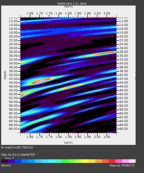
| Arrivals | |
| Ps | 5.1 SECOND |
| PpPs | 17 SECOND |
| PsPs/PpSs | 23 SECOND |

