You are here: Home > Network List > XM99 - Rio Grande Seismic Transect Stations List
> Station NM12 NewMexico12 > Earthquake Result Viewer
NM12 NewMexico12 - Earthquake Result Viewer
*The percent match for this event was below the threshold and hence no stack was calculated.
| Earthquake location: |
Southeast Of Loyalty Islands |
| Earthquake latitude/longitude: |
-22.0/170.1 |
| Earthquake time(UTC): |
2001/02/28 (059) 13:05:31 GMT |
| Earthquake Depth: |
10 km |
| Earthquake Magnitude: |
5.8 MB, 6.1 MS, 6.2 MW |
| Earthquake Catalog/Contributor: |
WHDF/NEIC |
|
| Network: |
XM Rio Grande Seismic Transect |
| Station: |
NM12 NewMexico12 |
| Lat/Lon: |
32.68 N/104.51 W |
| Elevation: |
1066 m |
|
| Distance: |
97.9 deg |
| Az: |
58.06 deg |
| Baz: |
249.045 deg |
| Ray Param: |
$rayparam |
*The percent match for this event was below the threshold and hence was not used in the summary stack. |
|
| Radial Match: |
98.54411 % |
| Radial Bump: |
242 |
| Transverse Match: |
72.7016 % |
| Transverse Bump: |
400 |
| SOD ConfigId: |
3744 |
| Insert Time: |
2010-02-26 17:24:51.491 +0000 |
| GWidth: |
2.5 |
| Max Bumps: |
400 |
| Tol: |
0.001 |
|
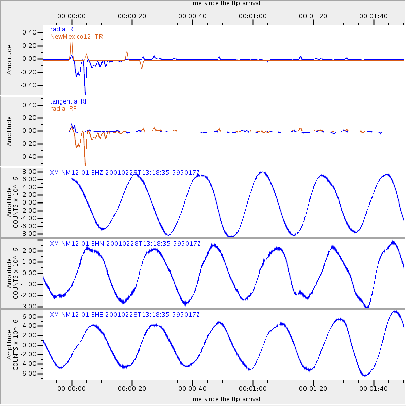
Signal To Noise
| Channel | StoN | STA | LTA |
| XM:NM12:01:BHN:20010228T13:18:35.595017Z | 0.88083977 | 1.2683882E-6 | 1.4399761E-6 |
| XM:NM12:01:BHE:20010228T13:18:35.595017Z | 0.6837812 | 1.7552941E-6 | 2.5670404E-6 |
| XM:NM12:01:BHZ:20010228T13:18:35.595017Z | 1.6513323 | 7.917324E-6 | 4.794507E-6 |
| Arrivals |
| Ps | |
| PpPs | |
| PsPs/PpSs | |


