
NM15 NewMexico15 - Earthquake Result Viewer
| ||||||||||||||||||
| ||||||||||||||||||
| ||||||||||||||||||
|
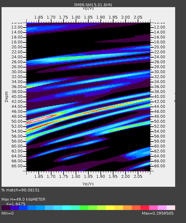
Signal To Noise
| Channel | StoN | STA | LTA |
| XM:NM15:01:BHN:20000328T11:12:57.16802Z | 1.1201952 | 1.8901459E-7 | 1.6873362E-7 |
| XM:NM15:01:BHE:20000328T11:12:57.16802Z | 1.9053628 | 2.0834958E-7 | 1.0934903E-7 |
| XM:NM15:01:BHZ:20000328T11:12:57.16802Z | 1.7593517 | 4.4055503E-7 | 2.504076E-7 |
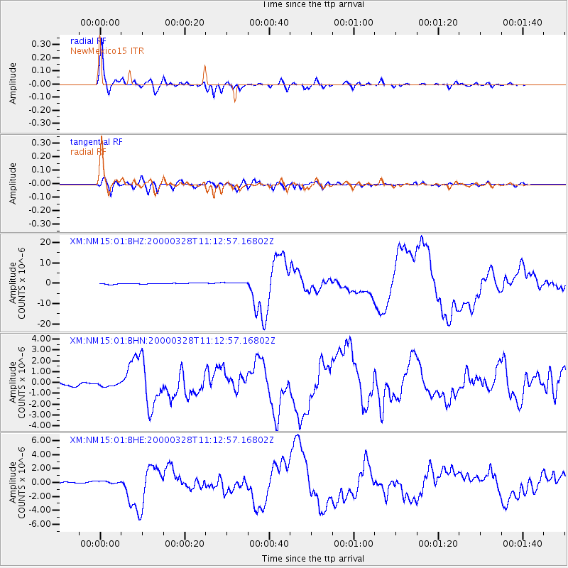
| Arrivals | |
| Ps | 5.2 SECOND |
| PpPs | 20 SECOND |
| PsPs/PpSs | 26 SECOND |

