NM15 NewMexico15 - Earthquake Result Viewer
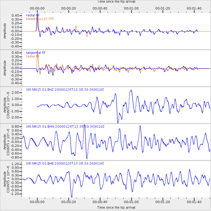
Earthquake location: Tonga Islands
Earthquake latitude/longitude: -17.3/-174.0
Earthquake time(UTC): 2000/01/26 (026) 13:26:50 GMT
Earthquake Depth: 33 km
Earthquake Magnitude: 5.9 MB, 6.0 MS, 6.4 MW, 6.3 MW
Earthquake Catalog/Contributor: WHDF/NEIC
Network: XM Rio Grande Seismic Transect
Station: NM15 NewMexico15
Lat/Lon: 33.01 N/104.91 W
Elevation: 1342 m
Distance: 82.7 deg
Az: 52.301 deg
Baz: 244.129 deg
Ray Param: 0.046637192
Estimated Moho Depth: 33.0 km
Estimated Crust Vp/Vs: 2.10
Assumed Crust Vp: 6.232 km/s
Estimated Crust Vs: 2.971 km/s
Estimated Crust Poisson's Ratio: 0.35
Radial Match: 82.28154 %
Radial Bump: 371
Transverse Match: 70.56523 %
Transverse Bump: 345
SOD ConfigId: 27569
Insert Time: 2010-02-26 17:25:01.907 +0000
GWidth: 2.5
Max Bumps: 400
Tol: 0.001

Signal To Noise

ChannelStoNSTALTA
XM:NM15:01:BHN:20000126T13:38:39.369019Z0.85650011.7433807E-72.0354706E-7
XM:NM15:01:BHE:20000126T13:38:39.369019Z1.31699251.9504438E-71.4809832E-7
XM:NM15:01:BHZ:20000126T13:38:39.369019Z1.32297092.6923607E-72.0350869E-7
Arrivals
Ps5.9 SECOND
PpPs16 SECOND
PsPs/PpSs22 SECOND