NM15 NewMexico15 - Earthquake Result Viewer
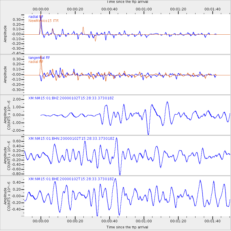
Earthquake location: Tonga Islands
Earthquake latitude/longitude: -20.8/-174.2
Earthquake time(UTC): 2000/01/02 (002) 15:16:32 GMT
Earthquake Depth: 33 km
Earthquake Magnitude: 5.5 MB, 5.8 MS, 5.8 MW, 5.8 MW
Earthquake Catalog/Contributor: WHDF/NEIC
Network: XM Rio Grande Seismic Transect
Station: NM15 NewMexico15
Lat/Lon: 33.01 N/104.91 W
Elevation: 1342 m
Distance: 85.0 deg
Az: 52.097 deg
Baz: 241.5 deg
Ray Param: 0.045004155
Estimated Moho Depth: 54.75 km
Estimated Crust Vp/Vs: 1.77
Assumed Crust Vp: 6.232 km/s
Estimated Crust Vs: 3.511 km/s
Estimated Crust Poisson's Ratio: 0.27
Radial Match: 86.099846 %
Radial Bump: 291
Transverse Match: 72.93584 %
Transverse Bump: 300
SOD ConfigId: 27569
Insert Time: 2010-02-26 17:25:03.819 +0000
GWidth: 2.5
Max Bumps: 400
Tol: 0.001

Signal To Noise

ChannelStoNSTALTA
XM:NM15:01:BHN:20000102T15:28:33.373018Z0.853495968.5510386E-81.00188394E-7
XM:NM15:01:BHE:20000102T15:28:33.373018Z1.41922531.0880663E-77.666621E-8
XM:NM15:01:BHZ:20000102T15:28:33.373018Z0.75628111.0335537E-71.3666263E-7
Arrivals
Ps7.0 SECOND
PpPs24 SECOND
PsPs/PpSs31 SECOND