NM15 NewMexico15 - Earthquake Result Viewer
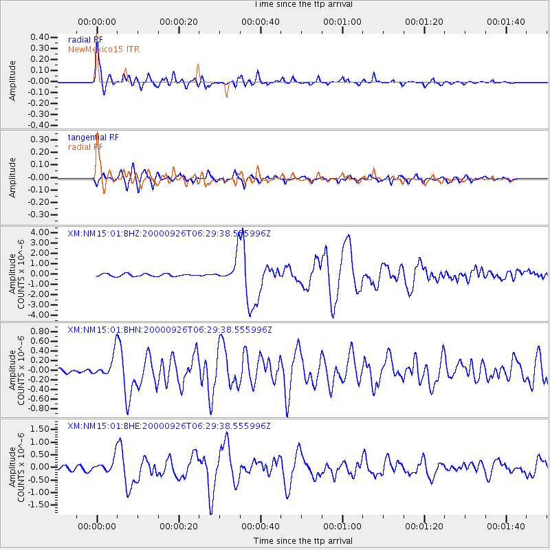
Earthquake location: Tonga Islands
Earthquake latitude/longitude: -17.2/-173.9
Earthquake time(UTC): 2000/09/26 (270) 06:17:52 GMT
Earthquake Depth: 56 km
Earthquake Magnitude: 6.1 MB, 6.1 MS, 6.4 MW, 6.1 ME
Earthquake Catalog/Contributor: WHDF/NEIC
Network: XM Rio Grande Seismic Transect
Station: NM15 NewMexico15
Lat/Lon: 33.01 N/104.91 W
Elevation: 1342 m
Distance: 82.6 deg
Az: 52.283 deg
Baz: 244.16 deg
Ray Param: 0.04665834
Estimated Moho Depth: 16.25 km
Estimated Crust Vp/Vs: 2.10
Assumed Crust Vp: 6.232 km/s
Estimated Crust Vs: 2.971 km/s
Estimated Crust Poisson's Ratio: 0.35
Radial Match: 96.91966 %
Radial Bump: 400
Transverse Match: 88.53964 %
Transverse Bump: 400
SOD ConfigId: 16820
Insert Time: 2010-02-26 17:25:07.422 +0000
GWidth: 2.5
Max Bumps: 400
Tol: 0.001

Signal To Noise

ChannelStoNSTALTA
XM:NM15:01:BHN:20000926T06:29:38.555996Z4.2313052.6575947E-76.280792E-8
XM:NM15:01:BHE:20000926T06:29:38.555996Z4.05411053.2245256E-77.9537195E-8
XM:NM15:01:BHZ:20000926T06:29:38.555996Z11.2347241.3791981E-61.2276209E-7
Arrivals
Ps2.9 SECOND
PpPs7.9 SECOND
PsPs/PpSs11 SECOND