NM14 NewMexico14 - Earthquake Result Viewer
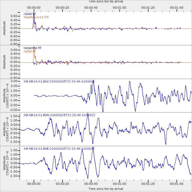
Earthquake location: Near Coast Of Ecuador
Earthquake latitude/longitude: -0.2/-80.6
Earthquake time(UTC): 2000/09/28 (272) 23:23:43 GMT
Earthquake Depth: 23 km
Earthquake Magnitude: 5.8 MB, 6.0 MS, 6.6 MW, 6.4 MW
Earthquake Catalog/Contributor: WHDF/NEIC
Network: XM Rio Grande Seismic Transect
Station: NM14 NewMexico14
Lat/Lon: 32.91 N/104.76 W
Elevation: 1219 m
Distance: 40.1 deg
Az: 327.632 deg
Baz: 140.476 deg
Ray Param: 0.07457883
Estimated Moho Depth: 54.75 km
Estimated Crust Vp/Vs: 2.08
Assumed Crust Vp: 6.232 km/s
Estimated Crust Vs: 2.996 km/s
Estimated Crust Poisson's Ratio: 0.35
Radial Match: 96.62417 %
Radial Bump: 269
Transverse Match: 85.752365 %
Transverse Bump: 400
SOD ConfigId: 16820
Insert Time: 2010-02-26 17:25:29.906 +0000
GWidth: 2.5
Max Bumps: 400
Tol: 0.001

Signal To Noise

ChannelStoNSTALTA
XM:NM14:01:BHN:20000928T23:30:46.016992Z2.4662211.5235682E-76.1777435E-8
XM:NM14:01:BHE:20000928T23:30:46.016992Z1.51724621.473836E-79.713888E-8
XM:NM14:01:BHZ:20000928T23:30:46.016992Z3.65503383.2415693E-78.8687806E-8
Arrivals
Ps10 SECOND
PpPs26 SECOND
PsPs/PpSs36 SECOND