
NM14 NewMexico14 - Earthquake Result Viewer
| ||||||||||||||||||
| ||||||||||||||||||
| ||||||||||||||||||
|
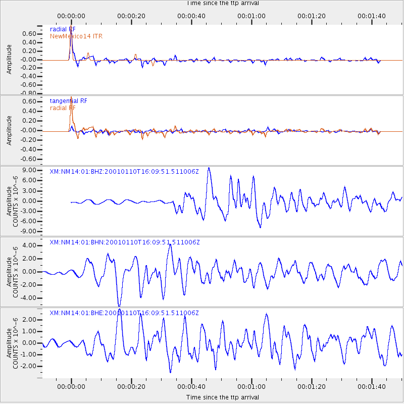
Signal To Noise
| Channel | StoN | STA | LTA |
| XM:NM14:01:BHN:20010110T16:09:51.511006Z | 2.5959716 | 5.317937E-7 | 2.0485345E-7 |
| XM:NM14:01:BHE:20010110T16:09:51.511006Z | 0.62082356 | 2.1340627E-7 | 3.4374708E-7 |
| XM:NM14:01:BHZ:20010110T16:09:51.511006Z | 1.6875421 | 7.2830403E-7 | 4.315768E-7 |
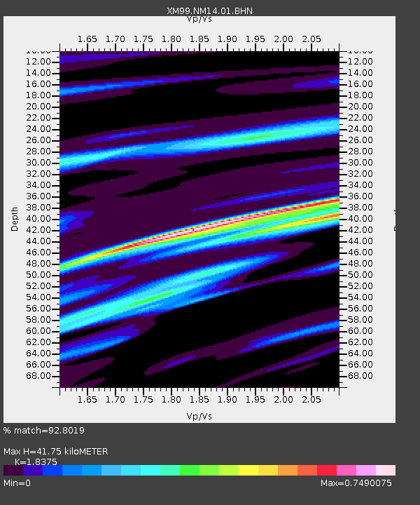
| Arrivals | |
| Ps | 6.0 SECOND |
| PpPs | 18 SECOND |
| PsPs/PpSs | 24 SECOND |

