
NM14 NewMexico14 - Earthquake Result Viewer
| ||||||||||||||||||
| ||||||||||||||||||
| ||||||||||||||||||
|
Signal To Noise
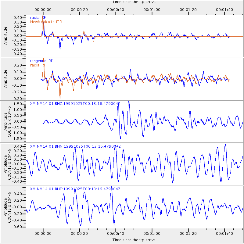
| Channel | StoN | STA | LTA |
| XM:NM14:01:BHN:19991025T00:13:16.479004Z | 0.5846505 | 9.097201E-8 | 1.5560066E-7 |
| XM:NM14:01:BHE:19991025T00:13:16.479004Z | 0.44493404 | 3.969181E-8 | 8.92083E-8 |
| XM:NM14:01:BHZ:19991025T00:13:16.479004Z | 2.014739 | 2.4699906E-7 | 1.2259606E-7 |
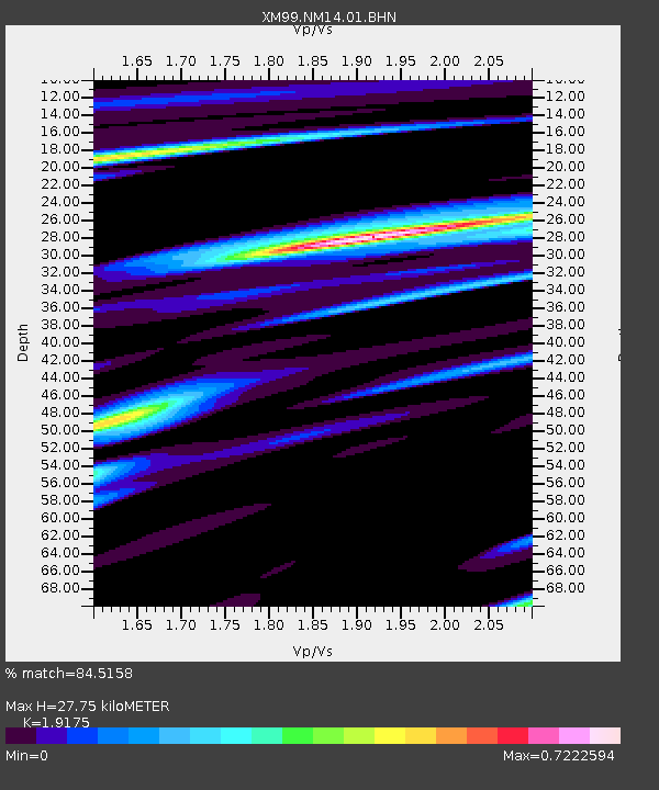
| Arrivals | |
| Ps | 4.2 SECOND |
| PpPs | 13 SECOND |
| PsPs/PpSs | 17 SECOND |

