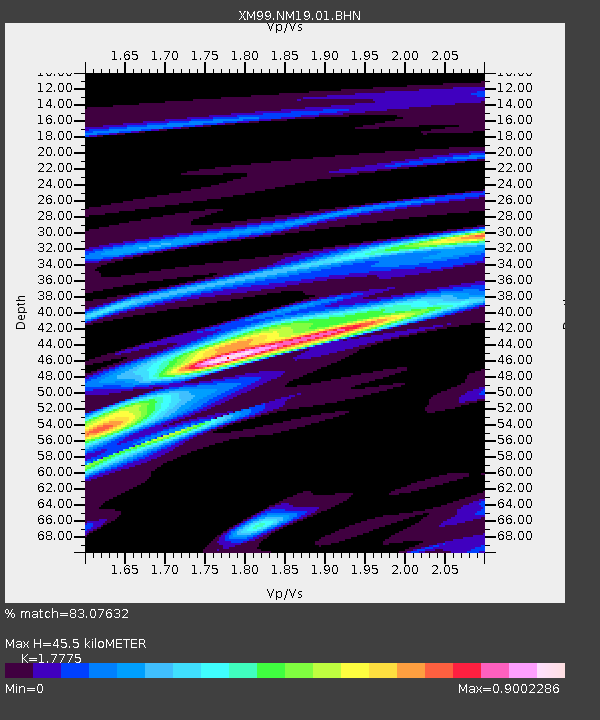
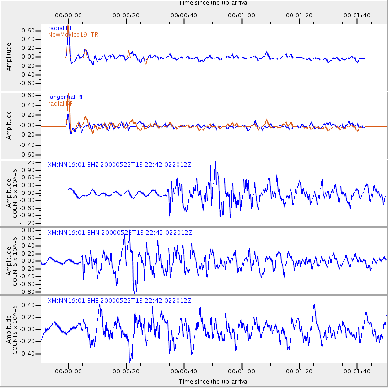
NM19 NewMexico19 - Earthquake Result Viewer

Earthquake location: Near Coast Of Northern Peru
Earthquake latitude/longitude: -4.1/-81.1
Earthquake time(UTC): 2000/05/22 (143) 13:15:08 GMT
Earthquake Depth: 33 km
Earthquake Magnitude: 5.3 MB, 5.4 MS, 5.8 MW, 5.8 MW
Earthquake Catalog/Contributor: WHDF/NEIC
Network: XM Rio Grande Seismic Transect
Station: NM19 NewMexico19
Lat/Lon: 33.49 N/105.46 W
Elevation: 2028 m
Distance: 43.9 deg
Az: 330.201 deg
Baz: 143.616 deg
Ray Param: 0.072175115
Estimated Moho Depth: 45.5 km
Estimated Crust Vp/Vs: 1.78
Assumed Crust Vp: 6.232 km/s
Estimated Crust Vs: 3.506 km/s
Estimated Crust Poisson's Ratio: 0.27
Radial Match: 83.07632 %
Radial Bump: 400
Transverse Match: 55.610485 %
Transverse Bump: 400
SOD ConfigId: 16820
Insert Time: 2010-02-26 17:26:27.296 +0000
GWidth: 2.5
Max Bumps: 400
Tol: 0.001

Signal To Noise

ChannelStoNSTALTA
XM:NM19:01:BHN:20000522T13:22:42.022012Z0.831603355.544173E-86.666848E-8
XM:NM19:01:BHE:20000522T13:22:42.022012Z0.890908967.4580015E-88.371228E-8
XM:NM19:01:BHZ:20000522T13:22:42.022012Z1.08498761.06186874E-79.7869204E-8
Arrivals
Ps6.0 SECOND
PpPs19 SECOND
PsPs/PpSs25 SECOND