
NM19 NewMexico19 - Earthquake Result Viewer
| ||||||||||||||||||
| ||||||||||||||||||
| ||||||||||||||||||
|
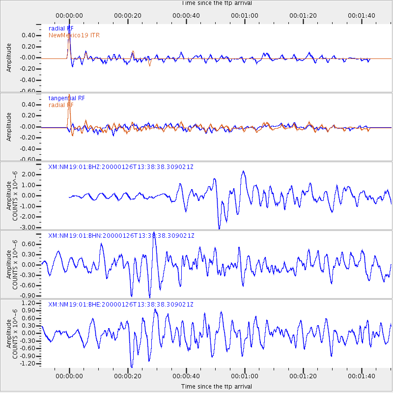
Signal To Noise
| Channel | StoN | STA | LTA |
| XM:NM19:01:BHN:20000126T13:38:38.309021Z | 0.9998203 | 1.7347398E-7 | 1.7350516E-7 |
| XM:NM19:01:BHE:20000126T13:38:38.309021Z | 0.8086876 | 1.4624241E-7 | 1.8083918E-7 |
| XM:NM19:01:BHZ:20000126T13:38:38.309021Z | 0.8340386 | 1.5887906E-7 | 1.9049367E-7 |
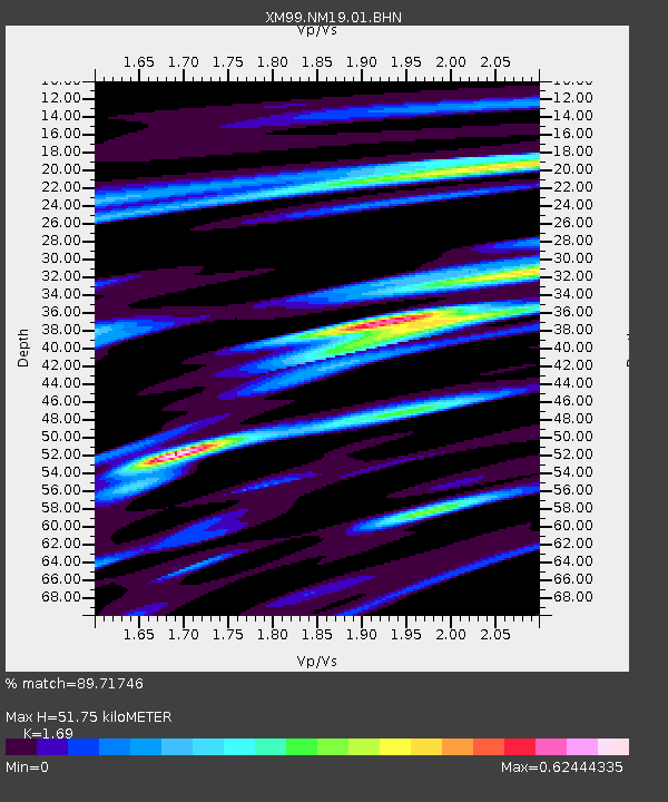
| Arrivals | |
| Ps | 5.9 SECOND |
| PpPs | 22 SECOND |
| PsPs/PpSs | 28 SECOND |

