NM19 NewMexico19 - Earthquake Result Viewer
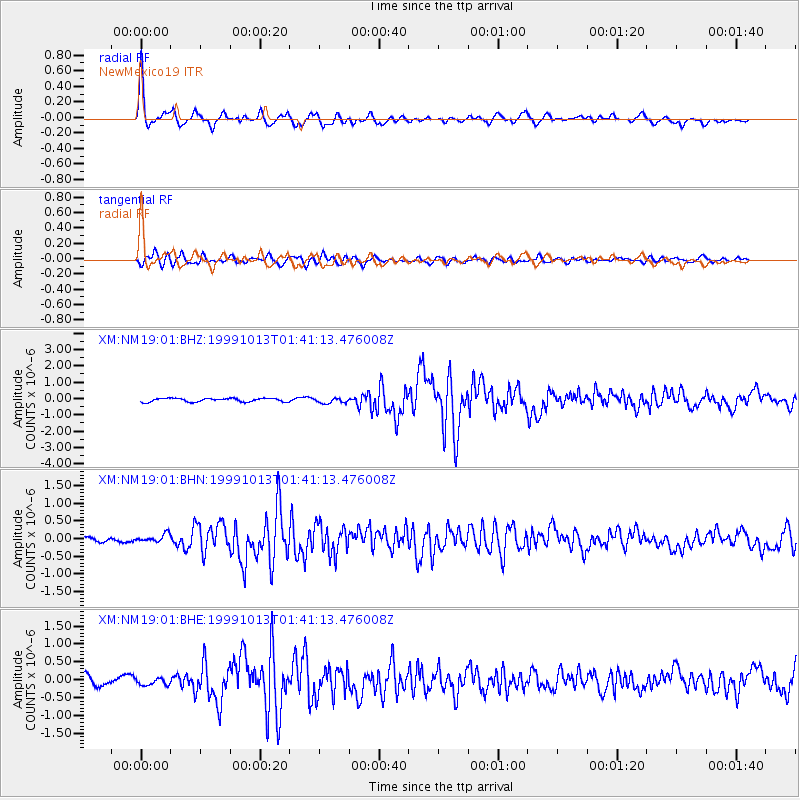
Earthquake location: Alaska Peninsula
Earthquake latitude/longitude: 54.7/-161.2
Earthquake time(UTC): 1999/10/13 (286) 01:33:40 GMT
Earthquake Depth: 30 km
Earthquake Magnitude: 6.0 MB, 6.2 MS, 6.5 MW, 6.0 ML
Earthquake Catalog/Contributor: WHDF/NEIC
Network: XM Rio Grande Seismic Transect
Station: NM19 NewMexico19
Lat/Lon: 33.49 N/105.46 W
Elevation: 2028 m
Distance: 43.9 deg
Az: 95.278 deg
Baz: 316.182 deg
Ray Param: 0.07218452
Estimated Moho Depth: 21.75 km
Estimated Crust Vp/Vs: 1.79
Assumed Crust Vp: 6.232 km/s
Estimated Crust Vs: 3.491 km/s
Estimated Crust Poisson's Ratio: 0.27
Radial Match: 87.632774 %
Radial Bump: 400
Transverse Match: 80.04047 %
Transverse Bump: 400
SOD ConfigId: 27569
Insert Time: 2010-02-26 17:26:35.583 +0000
GWidth: 2.5
Max Bumps: 400
Tol: 0.001

Signal To Noise

ChannelStoNSTALTA
XM:NM19:01:BHN:19991013T01:41:13.476008Z0.88261231.0478082E-71.187167E-7
XM:NM19:01:BHE:19991013T01:41:13.476008Z0.59176849.134542E-81.5436008E-7
XM:NM19:01:BHZ:19991013T01:41:13.476008Z1.48345381.6173182E-71.0902384E-7
Arrivals
Ps2.9 SECOND
PpPs9.1 SECOND
PsPs/PpSs12 SECOND