MOL Molde - Earthquake Result Viewer
Earthquake location: Hokkaido, Japan Region
Earthquake latitude/longitude: 41.0/142.3
Earthquake time(UTC): 2001/08/13 (225) 20:11:23 GMT
Earthquake Depth: 38 km
Earthquake Magnitude: 6.0 MB, 6.3 MS, 6.4 MW, 6.3 ME
Earthquake Catalog/Contributor: WHDF/NEIC
Network: YV North East Atlantic Tomography (NEAT)
Station: MOL Molde
Lat/Lon: 62.57 N/7.55 E
Elevation: 0.0 m
Distance: 70.5 deg
Az: 339.589 deg
Baz: 34.721 deg
Ray Param: 0.054851055
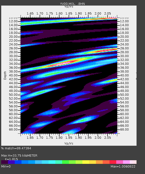
Estimated Moho Depth: 33.75 km
Estimated Crust Vp/Vs: 1.82
Assumed Crust Vp: 6.391 km/s
Estimated Crust Vs: 3.521 km/s
Estimated Crust Poisson's Ratio: 0.28
Radial Match: 89.47394 %
Radial Bump: 400
Transverse Match: 63.377945 %
Transverse Bump: 400
SOD ConfigId: 16820
Insert Time: 2010-03-09 20:40:45.021 +0000
GWidth: 2.5
Max Bumps: 400
Tol: 0.001

Signal To Noise

ChannelStoNSTALTA
YV:MOL: :BHN:20010813T20:22:03.54502Z3.51443582.1108758E-66.006301E-7
YV:MOL: :BHE:20010813T20:22:03.54502Z2.47015481.5609976E-66.3194324E-7
YV:MOL: :BHZ:20010813T20:22:03.54502Z6.4154845.1116995E-67.9677534E-7
Arrivals
Ps4.5 SECOND
PpPs14 SECOND
PsPs/PpSs19 SECOND