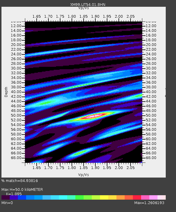
UT54 Utah54 - Earthquake Result Viewer
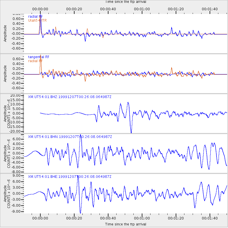
Earthquake location: Kodiak Island Region, Alaska
Earthquake latitude/longitude: 57.4/-154.5
Earthquake time(UTC): 1999/12/07 (341) 00:19:49 GMT
Earthquake Depth: 41 km
Earthquake Magnitude: 6.5 MB, 6.1 MS, 6.4 MW, 6.3 ML
Earthquake Catalog/Contributor: WHDF/NEIC
Network: XM Rio Grande Seismic Transect
Station: UT54 Utah54
Lat/Lon: 37.42 N/110.51 W
Elevation: 1439 m
Distance: 35.0 deg
Az: 105.498 deg
Baz: 319.014 deg
Ray Param: 0.07734795
Estimated Moho Depth: 50.0 km
Estimated Crust Vp/Vs: 1.89
Assumed Crust Vp: 6.247 km/s
Estimated Crust Vs: 3.296 km/s
Estimated Crust Poisson's Ratio: 0.31
Radial Match: 84.93816 %
Radial Bump: 400
Transverse Match: 68.704765 %
Transverse Bump: 400
SOD ConfigId: 27569
Insert Time: 2010-02-26 17:28:08.532 +0000
GWidth: 2.5
Max Bumps: 400
Tol: 0.001

Signal To Noise

ChannelStoNSTALTA
XM:UT54:01:BHN:19991207T00:26:08.064987Z2.47304751.5118537E-66.1133227E-7
XM:UT54:01:BHE:19991207T00:26:08.064987Z2.44860221.5860862E-66.4775173E-7
XM:UT54:01:BHZ:19991207T00:26:08.064987Z6.23339464.2041397E-66.744542E-7
Arrivals
Ps7.7 SECOND
PpPs22 SECOND
PsPs/PpSs29 SECOND