NM32 NewMexico32 - Earthquake Result Viewer
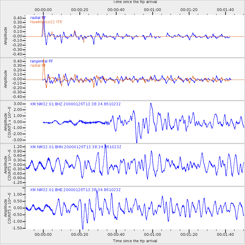
Earthquake location: Tonga Islands
Earthquake latitude/longitude: -17.3/-174.0
Earthquake time(UTC): 2000/01/26 (026) 13:26:50 GMT
Earthquake Depth: 33 km
Earthquake Magnitude: 5.9 MB, 6.0 MS, 6.4 MW, 6.3 MW
Earthquake Catalog/Contributor: WHDF/NEIC
Network: XM Rio Grande Seismic Transect
Station: NM32 NewMexico32
Lat/Lon: 34.98 N/107.26 W
Elevation: 1685 m
Distance: 81.9 deg
Az: 49.646 deg
Baz: 242.463 deg
Ray Param: 0.047239352
Estimated Moho Depth: 44.25 km
Estimated Crust Vp/Vs: 1.64
Assumed Crust Vp: 6.502 km/s
Estimated Crust Vs: 3.958 km/s
Estimated Crust Poisson's Ratio: 0.21
Radial Match: 81.042694 %
Radial Bump: 326
Transverse Match: 64.63804 %
Transverse Bump: 394
SOD ConfigId: 27569
Insert Time: 2010-02-26 17:29:29.185 +0000
GWidth: 2.5
Max Bumps: 400
Tol: 0.001

Signal To Noise

ChannelStoNSTALTA
XM:NM32:01:BHN:20000126T13:38:34.861023Z1.23977672.3534366E-71.8982746E-7
XM:NM32:01:BHE:20000126T13:38:34.861023Z1.28092861.5991058E-71.2483957E-7
XM:NM32:01:BHZ:20000126T13:38:34.861023Z0.71184611.2519831E-71.7587834E-7
Arrivals
Ps4.5 SECOND
PpPs17 SECOND
PsPs/PpSs22 SECOND