
NM32 NewMexico32 - Earthquake Result Viewer
| ||||||||||||||||||
| ||||||||||||||||||
| ||||||||||||||||||
|
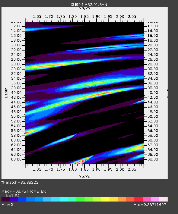
Signal To Noise
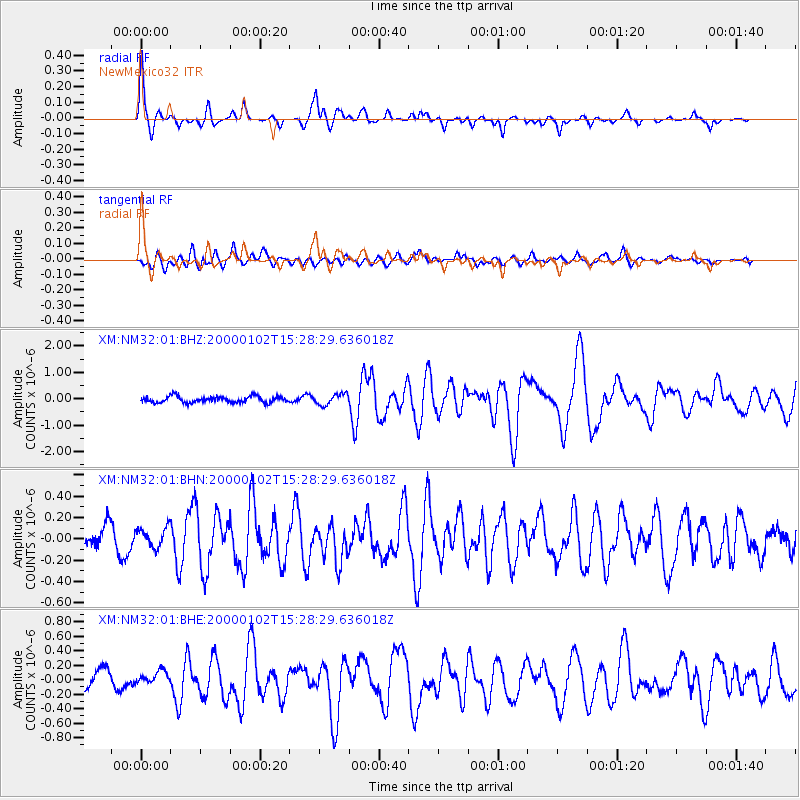
| Channel | StoN | STA | LTA |
| XM:NM32:01:BHN:20000102T15:28:29.636018Z | 1.0772213 | 9.313988E-8 | 8.646309E-8 |
| XM:NM32:01:BHE:20000102T15:28:29.636018Z | 0.83767176 | 9.1145246E-8 | 1.0880783E-7 |
| XM:NM32:01:BHZ:20000102T15:28:29.636018Z | 1.7744559 | 2.066667E-7 | 1.16467646E-7 |
| Arrivals | |
| Ps | 9.1 SECOND |
| PpPs | 29 SECOND |
| PsPs/PpSs | 38 SECOND |

