NM32 NewMexico32 - Earthquake Result Viewer
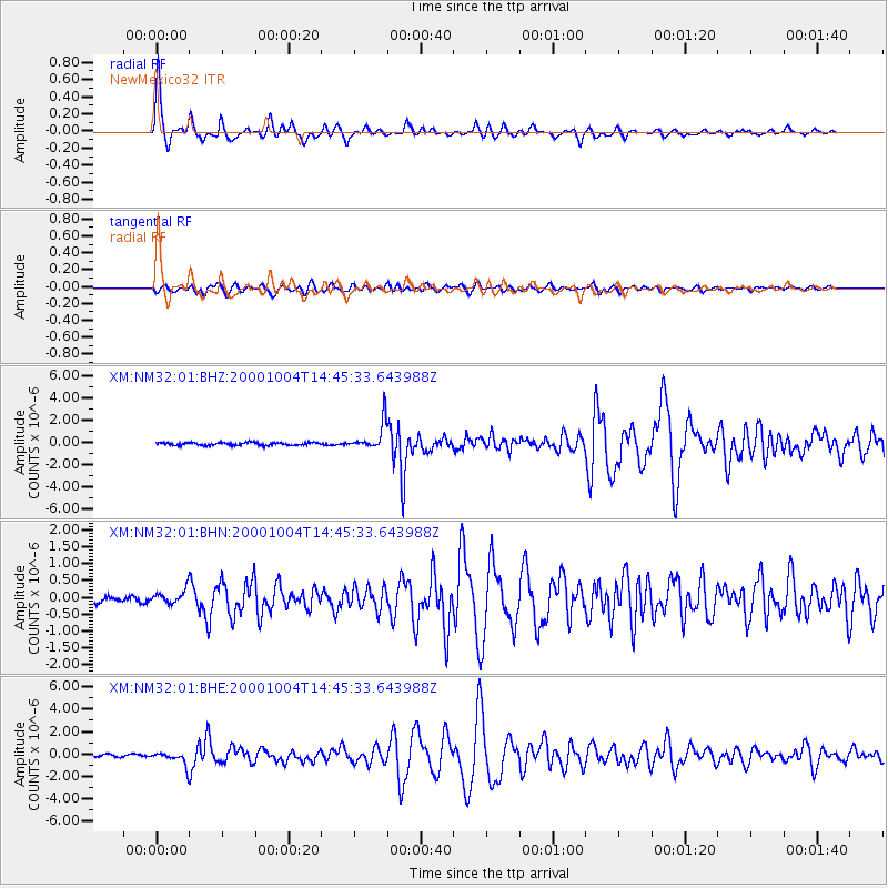
Earthquake location: Windward Islands
Earthquake latitude/longitude: 11.1/-62.6
Earthquake time(UTC): 2000/10/04 (278) 14:37:44 GMT
Earthquake Depth: 110 km
Earthquake Magnitude: 5.6 MB, 5.4 MS, 6.1 MW, 5.9 MD
Earthquake Catalog/Contributor: WHDF/NEIC
Network: XM Rio Grande Seismic Transect
Station: NM32 NewMexico32
Lat/Lon: 34.98 N/107.26 W
Elevation: 1685 m
Distance: 47.0 deg
Az: 307.812 deg
Baz: 109.22 deg
Ray Param: 0.06990488
Estimated Moho Depth: 44.25 km
Estimated Crust Vp/Vs: 1.71
Assumed Crust Vp: 6.502 km/s
Estimated Crust Vs: 3.797 km/s
Estimated Crust Poisson's Ratio: 0.24
Radial Match: 97.024635 %
Radial Bump: 325
Transverse Match: 88.70615 %
Transverse Bump: 400
SOD ConfigId: 16820
Insert Time: 2010-02-26 17:29:36.324 +0000
GWidth: 2.5
Max Bumps: 400
Tol: 0.001

Signal To Noise

ChannelStoNSTALTA
XM:NM32:01:BHN:20001004T14:45:33.643988Z2.04728842.2116431E-71.08027926E-7
XM:NM32:01:BHE:20001004T14:45:33.643988Z7.3140756.2519484E-78.547832E-8
XM:NM32:01:BHZ:20001004T14:45:33.643988Z10.5298511.2506988E-61.1877649E-7
Arrivals
Ps5.2 SECOND
PpPs17 SECOND
PsPs/PpSs22 SECOND