NM32 NewMexico32 - Earthquake Result Viewer
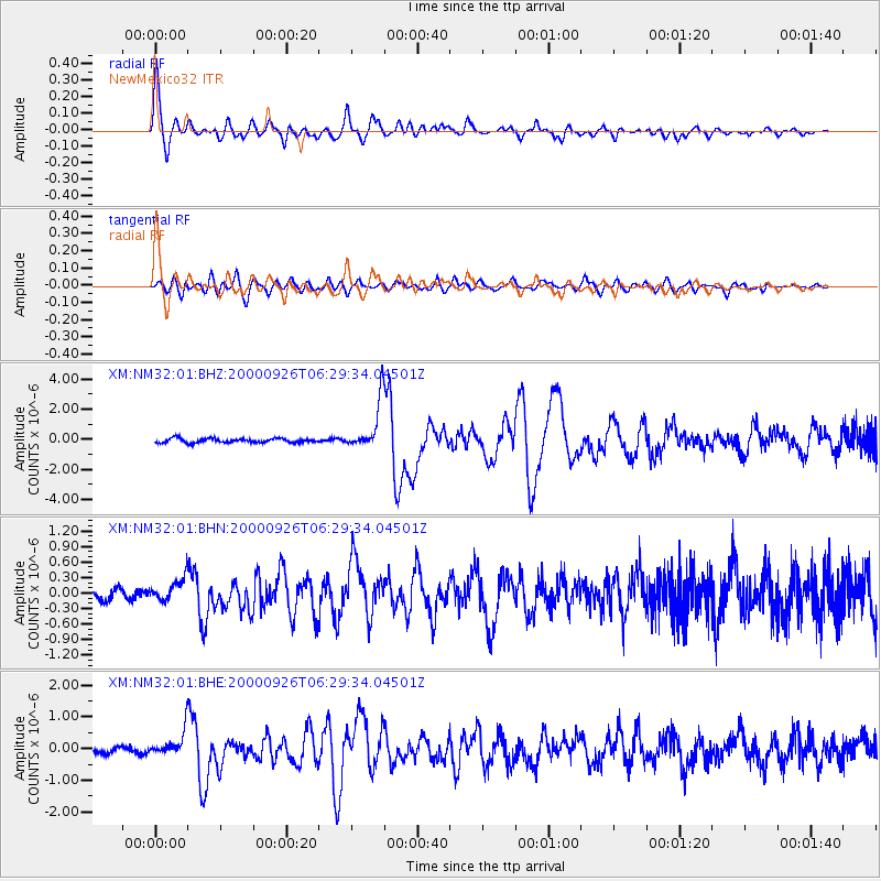
Earthquake location: Tonga Islands
Earthquake latitude/longitude: -17.2/-173.9
Earthquake time(UTC): 2000/09/26 (270) 06:17:52 GMT
Earthquake Depth: 56 km
Earthquake Magnitude: 6.1 MB, 6.1 MS, 6.4 MW, 6.1 ME
Earthquake Catalog/Contributor: WHDF/NEIC
Network: XM Rio Grande Seismic Transect
Station: NM32 NewMexico32
Lat/Lon: 34.98 N/107.26 W
Elevation: 1685 m
Distance: 81.8 deg
Az: 49.627 deg
Baz: 242.488 deg
Ray Param: 0.047260746
Estimated Moho Depth: 33.0 km
Estimated Crust Vp/Vs: 1.98
Assumed Crust Vp: 6.502 km/s
Estimated Crust Vs: 3.292 km/s
Estimated Crust Poisson's Ratio: 0.33
Radial Match: 94.99867 %
Radial Bump: 378
Transverse Match: 86.23882 %
Transverse Bump: 400
SOD ConfigId: 16820
Insert Time: 2010-02-26 17:29:37.603 +0000
GWidth: 2.5
Max Bumps: 400
Tol: 0.001

Signal To Noise

ChannelStoNSTALTA
XM:NM32:01:BHN:20000926T06:29:34.04501Z2.38481972.2289719E-79.3465005E-8
XM:NM32:01:BHE:20000926T06:29:34.04501Z5.13245154.0565376E-77.903704E-8
XM:NM32:01:BHZ:20000926T06:29:34.04501Z11.446581.6050602E-61.4022183E-7
Arrivals
Ps5.1 SECOND
PpPs15 SECOND
PsPs/PpSs20 SECOND