NM32 NewMexico32 - Earthquake Result Viewer
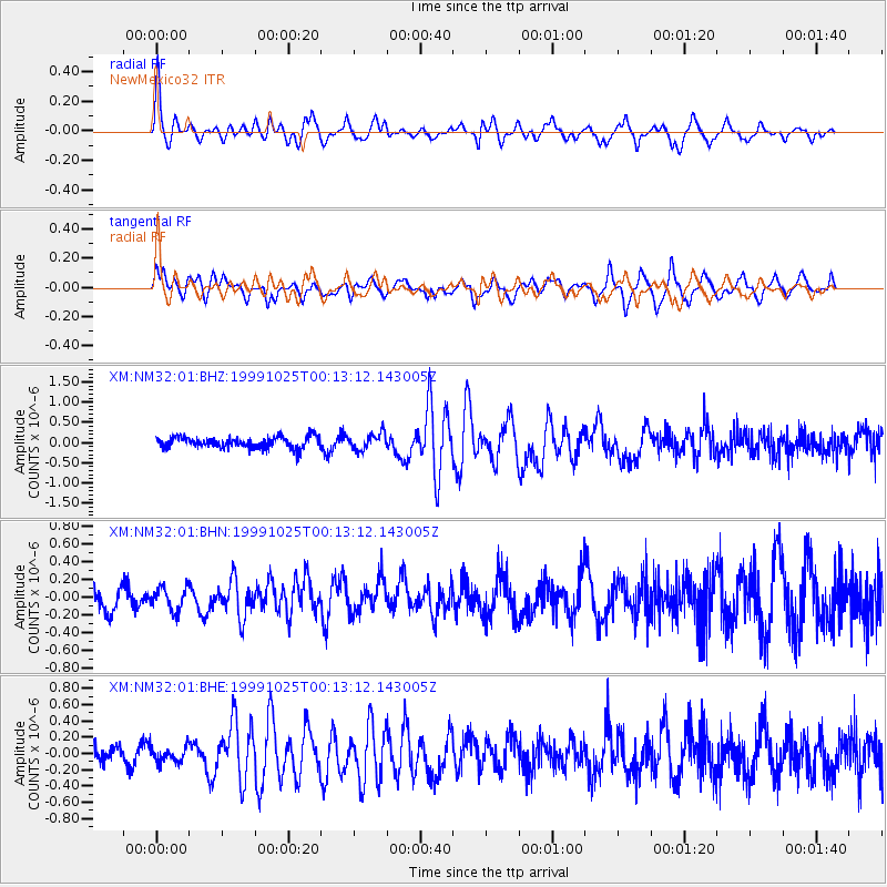
Earthquake location: Tonga Islands
Earthquake latitude/longitude: -19.4/-173.9
Earthquake time(UTC): 1999/10/25 (298) 00:01:20 GMT
Earthquake Depth: 33 km
Earthquake Magnitude: 5.5 MB, 5.6 MS, 5.8 MW, 5.7 MW
Earthquake Catalog/Contributor: WHDF/NEIC
Network: XM Rio Grande Seismic Transect
Station: NM32 NewMexico32
Lat/Lon: 34.98 N/107.26 W
Elevation: 1685 m
Distance: 83.2 deg
Az: 49.382 deg
Baz: 240.731 deg
Ray Param: 0.046326615
Estimated Moho Depth: 34.25 km
Estimated Crust Vp/Vs: 1.93
Assumed Crust Vp: 6.502 km/s
Estimated Crust Vs: 3.364 km/s
Estimated Crust Poisson's Ratio: 0.32
Radial Match: 81.99382 %
Radial Bump: 319
Transverse Match: 68.69545 %
Transverse Bump: 400
SOD ConfigId: 27569
Insert Time: 2010-02-26 17:29:42.746 +0000
GWidth: 2.5
Max Bumps: 400
Tol: 0.001

Signal To Noise

ChannelStoNSTALTA
XM:NM32:01:BHN:19991025T00:13:12.143005Z1.06081751.2854218E-71.2117276E-7
XM:NM32:01:BHE:19991025T00:13:12.143005Z0.79859379.820009E-81.2296627E-7
XM:NM32:01:BHZ:19991025T00:13:12.143005Z1.45141352.0067523E-71.3826192E-7
Arrivals
Ps5.0 SECOND
PpPs15 SECOND
PsPs/PpSs20 SECOND