NM30 NewMexico30 - Earthquake Result Viewer
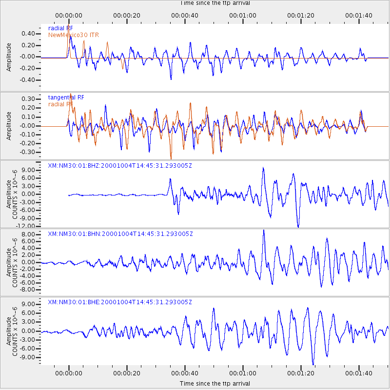
Earthquake location: Windward Islands
Earthquake latitude/longitude: 11.1/-62.6
Earthquake time(UTC): 2000/10/04 (278) 14:37:44 GMT
Earthquake Depth: 110 km
Earthquake Magnitude: 5.6 MB, 5.4 MS, 6.1 MW, 5.9 MD
Earthquake Catalog/Contributor: WHDF/NEIC
Network: XM Rio Grande Seismic Transect
Station: NM30 NewMexico30
Lat/Lon: 34.74 N/106.97 W
Elevation: 1515 m
Distance: 46.7 deg
Az: 307.613 deg
Baz: 109.249 deg
Ray Param: 0.07010408
Estimated Moho Depth: 19.75 km
Estimated Crust Vp/Vs: 1.61
Assumed Crust Vp: 6.502 km/s
Estimated Crust Vs: 4.032 km/s
Estimated Crust Poisson's Ratio: 0.19
Radial Match: 85.938736 %
Radial Bump: 400
Transverse Match: 82.12573 %
Transverse Bump: 400
SOD ConfigId: 16820
Insert Time: 2010-02-26 17:30:45.935 +0000
GWidth: 2.5
Max Bumps: 400
Tol: 0.001

Signal To Noise

ChannelStoNSTALTA
XM:NM30:01:BHN:20001004T14:45:31.293005Z0.537222743.732877E-76.9484713E-7
XM:NM30:01:BHE:20001004T14:45:31.293005Z1.34102053.2950447E-72.4571173E-7
XM:NM30:01:BHZ:20001004T14:45:31.293005Z6.52019551.1033896E-61.6922647E-7
Arrivals
Ps2.0 SECOND
PpPs7.4 SECOND
PsPs/PpSs9.4 SECOND