NM28 NewMexico28 - Earthquake Result Viewer
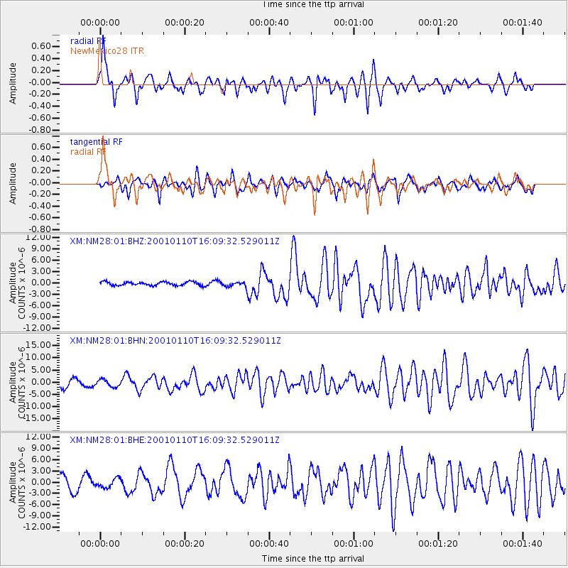
Earthquake location: Kodiak Island Region, Alaska
Earthquake latitude/longitude: 57.1/-153.2
Earthquake time(UTC): 2001/01/10 (010) 16:02:44 GMT
Earthquake Depth: 33 km
Earthquake Magnitude: 6.2 MB, 6.8 MS, 7.1 MW, 6.8 ML
Earthquake Catalog/Contributor: WHDF/NEIC
Network: XM Rio Grande Seismic Transect
Station: NM28 NewMexico28
Lat/Lon: 34.54 N/106.70 W
Elevation: 1484 m
Distance: 38.5 deg
Az: 105.646 deg
Baz: 320.432 deg
Ray Param: 0.07548613
Estimated Moho Depth: 19.0 km
Estimated Crust Vp/Vs: 1.60
Assumed Crust Vp: 6.502 km/s
Estimated Crust Vs: 4.063 km/s
Estimated Crust Poisson's Ratio: 0.18
Radial Match: 83.02939 %
Radial Bump: 400
Transverse Match: 77.924484 %
Transverse Bump: 400
SOD ConfigId: 3744
Insert Time: 2010-02-26 17:31:28.482 +0000
GWidth: 2.5
Max Bumps: 400
Tol: 0.001

Signal To Noise

ChannelStoNSTALTA
XM:NM28:01:BHN:20010110T16:09:32.529011Z0.8752581.4573004E-61.6649952E-6
XM:NM28:01:BHE:20010110T16:09:32.529011Z0.778487441.2107123E-61.5552112E-6
XM:NM28:01:BHZ:20010110T16:09:32.529011Z1.49277757.088091E-74.748257E-7
Arrivals
Ps1.9 SECOND
PpPs7.0 SECOND
PsPs/PpSs8.9 SECOND