NM28 NewMexico28 - Earthquake Result Viewer
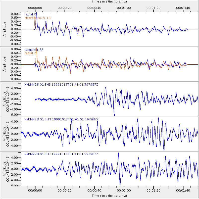
Earthquake location: Alaska Peninsula
Earthquake latitude/longitude: 54.7/-161.2
Earthquake time(UTC): 1999/10/13 (286) 01:33:40 GMT
Earthquake Depth: 30 km
Earthquake Magnitude: 6.0 MB, 6.2 MS, 6.5 MW, 6.0 ML
Earthquake Catalog/Contributor: WHDF/NEIC
Network: XM Rio Grande Seismic Transect
Station: NM28 NewMexico28
Lat/Lon: 34.54 N/106.70 W
Elevation: 1484 m
Distance: 42.4 deg
Az: 95.297 deg
Baz: 315.503 deg
Ray Param: 0.07312004
Estimated Moho Depth: 51.0 km
Estimated Crust Vp/Vs: 1.88
Assumed Crust Vp: 6.502 km/s
Estimated Crust Vs: 3.449 km/s
Estimated Crust Poisson's Ratio: 0.30
Radial Match: 81.51577 %
Radial Bump: 400
Transverse Match: 72.365074 %
Transverse Bump: 400
SOD ConfigId: 27569
Insert Time: 2010-02-26 17:31:29.708 +0000
GWidth: 2.5
Max Bumps: 400
Tol: 0.001

Signal To Noise

ChannelStoNSTALTA
XM:NM28:01:BHN:19991013T01:41:01.597987Z0.434279982.9098942E-76.700503E-7
XM:NM28:01:BHE:19991013T01:41:01.597987Z1.17063144.9822756E-74.2560586E-7
XM:NM28:01:BHZ:19991013T01:41:01.597987Z2.47866064.4017503E-71.7758585E-7
Arrivals
Ps7.4 SECOND
PpPs21 SECOND
PsPs/PpSs29 SECOND