NM28 NewMexico28 - Earthquake Result Viewer
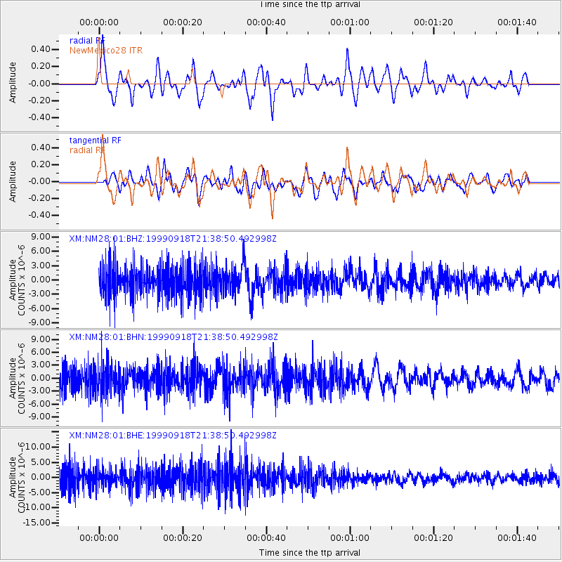
Earthquake location: Near East Coast Of Kamchatka
Earthquake latitude/longitude: 51.2/157.6
Earthquake time(UTC): 1999/09/18 (261) 21:28:33 GMT
Earthquake Depth: 60 km
Earthquake Magnitude: 5.9 MB, 5.6 MS, 6.2 MW, 6.0 MW
Earthquake Catalog/Contributor: WHDF/NEIC
Network: XM Rio Grande Seismic Transect
Station: NM28 NewMexico28
Lat/Lon: 34.54 N/106.70 W
Elevation: 1484 m
Distance: 67.2 deg
Az: 62.958 deg
Baz: 317.256 deg
Ray Param: 0.056948572
Estimated Moho Depth: 31.25 km
Estimated Crust Vp/Vs: 2.04
Assumed Crust Vp: 6.502 km/s
Estimated Crust Vs: 3.195 km/s
Estimated Crust Poisson's Ratio: 0.34
Radial Match: 88.89076 %
Radial Bump: 399
Transverse Match: 69.86833 %
Transverse Bump: 400
SOD ConfigId: 27569
Insert Time: 2010-02-26 17:31:32.172 +0000
GWidth: 2.5
Max Bumps: 400
Tol: 0.001

Signal To Noise

ChannelStoNSTALTA
XM:NM28:01:BHN:19990918T21:38:50.492998Z1.05515363.62173E-63.4324198E-6
XM:NM28:01:BHE:19990918T21:38:50.492998Z0.837280042.794231E-63.3372717E-6
XM:NM28:01:BHZ:19990918T21:38:50.492998Z0.858341342.7923381E-63.253179E-6
Arrivals
Ps5.2 SECOND
PpPs14 SECOND
PsPs/PpSs19 SECOND